Nuevo Guerrero geodata
Nuevo Guerrero (Guerrero) is a populated place; located in Mexico in America/Mexico_City (GMT-6) time zone. With population of 1,411 people, there are 6128 cities with bigger population in this country. Compared to other cities in Mexico, 75.9% of cities are located further ↑North; 69.8% of cities are located further →East and 73.5% of cities have higher elevation than Nuevo Guerrero. Note1


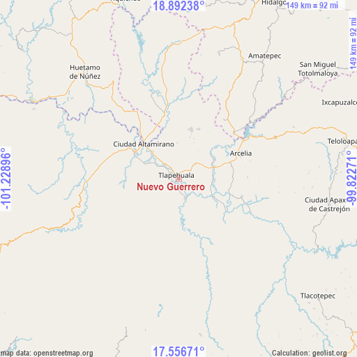
Nuevo Guerrero GPS coordinates[2]
18° 13' 32.988" North, 100° 31' 32.988" West
| Map corner | latitude | longitude |
|---|---|---|
| Upper-left | 18.89238°, | -101.22896° |
| Center: | 18.22583°, | -100.52583° |
| Lower-right: | 17.55671°, | -99.82271° |
| Map W x H: | 148.5×148.5 km | = 92.3×92.3mi |
| max Lat: | 32.7° ⇑75.9% North |
| Nuevo Guerrero: | 18.22583° |
| min Lat: | ⇓24.1% South 14.53588° |
| min Long | Nuevo Guerrero | max Long |
| -117.105° | -100.52583° | -86.73105° |
| W 30.2%⇐ | ⇒69.8% E |
Elevation
Elevation of Nuevo Guerrero is 272 m = 892 ft, and this is 981.7 m = 3221 ft below average elevation for this country.
| Max E: |
3497 m = 11473 ft | 73.5% |
| Avg. | 1253.7 m = 4113 ft | |
| Nuevo Guerrero | 272 m = 892 ft | |
Min E: |
-1 m = -3 ft | 26.5% |
See also: Mexico elevation on elevation.city.
Geographical zone
Nuevo Guerrero is located in North Torrid zone (between Equator and Tropic of Cancer). Distance of this Northern Tropic circle is 579.4 km =360 mi to North.| Distance of | km | miles | from Nuevo Guerrero |
|---|---|---|---|
| North Pole | 7980.5 | 4958.9 | to North |
| Arctic Circle | 5374.7 | 3339.7 | to North |
| Tropic Cancer | 579.4 | 360 | to North |
| Equator | 2026.5 | 1259.2 | to South |


Nearby cities:
15 places around Nuevo Guerrero: (largest is in red/bold)
• Ayavitle
3.7 km =2.3 mi,  138°
138°
• Cantón de Guerrero
1.8 km =1.1 mi,  287°
287°
• Changata
8.2 km =5.1 mi,  309°
309°
• Corral Falso
4.2 km =2.6 mi,  300°
300°
• Las Anonitas
5.8 km =3.6 mi,  247°
247°
• Morelita
6.4 km =4 mi,  320°
320°
• Rincón del Gallo (San José Guadalupe)
5.7 km =3.5 mi,  19°
19°
• San Antonio de las Huertas
6.2 km =3.9 mi,  7°
7°
• San Cristóbal
7.4 km =4.6 mi,  146°
146°
• San Jerónimo el Grande
3 km =1.9 mi,  121°
121°
• San Mateo
3.3 km =2.1 mi,  161°
161°
• Santa Rosa de Lima Dos
7.4 km =4.6 mi,  198°
198°
• Tiringueo
5.8 km =3.6 mi, 324°
• Tlapehuala
2.1 km =1.3 mi, 322°
• Villa Nicolás Bravo
2.7 km =1.7 mi,  241°
241°
Sources, notices
• [Note1] Compared only with cities in Mexico existing in our database
• [Src1] Map data: © OpenStreetMap contributors (CC-BY-SA)
• [Src2] Other city data from geonames.org with taken over terms of usage.
• [Src3] Geographical zone / Annual Mean Temperature by Robert A. Rohde @ Wikipedia
