San Cristóbal geodata
San Cristóbal (Guerrero) is a populated place; located in Mexico in America/Mexico_City (GMT-6) time zone. With population of 1,253 people, there are 6913 cities with bigger population in this country. Compared to other cities in Mexico, 76.5% of cities are located further ↑North; 69.4% of cities are located further →East and 73% of cities have higher elevation than San Cristóbal. Note1


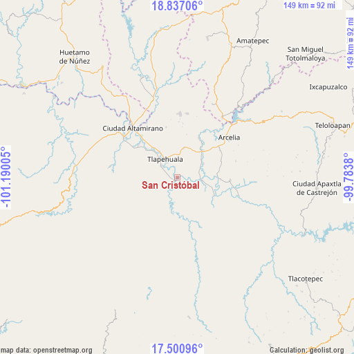
San Cristóbal GPS coordinates[2]
18° 10' 13.044" North, 100° 29' 12.912" West
| Map corner | latitude | longitude |
|---|---|---|
| Upper-left | 18.83706°, | -101.19005° |
| Center: | 18.17029°, | -100.48692° |
| Lower-right: | 17.50096°, | -99.7838° |
| Map W x H: | 148.6×148.6 km | = 92.3×92.3mi |
| max Lat: | 32.7° ⇑76.5% North |
| San Cristóbal: | 18.17029° |
| min Lat: | ⇓23.5% South 14.53588° |
| min Long | San Cristóbal | max Long |
| -117.105° | -100.48692° | -86.73105° |
| W 30.6%⇐ | ⇒69.4% E |
Elevation
Elevation of San Cristóbal is 289 m = 948 ft, and this is 964.7 m = 3165 ft below average elevation for this country.
| Max E: |
3497 m = 11473 ft | 73% |
| Avg. | 1253.7 m = 4113 ft | |
| San Cristóbal | 289 m = 948 ft | |
Min E: |
-1 m = -3 ft | 27% |
See also: Mexico elevation on elevation.city.
Geographical zone
San Cristóbal is located in North Torrid zone (between Equator and Tropic of Cancer). Distance of this Northern Tropic circle is 585.6 km =363.9 mi to North.| Distance of | km | miles | from San Cristóbal |
|---|---|---|---|
| North Pole | 7986.7 | 4962.7 | to North |
| Arctic Circle | 5380.8 | 3343.5 | to North |
| Tropic Cancer | 585.6 | 363.9 | to North |
| Equator | 2020.3 | 1255.4 | to South |


Nearby cities:
15 places around San Cristóbal: (largest is in red/bold)
• Ajuchitlán del Progreso
2.1 km =1.3 mi,  170°
170°
• Ayavitle
3.8 km =2.4 mi,  333°
333°
• Cantón de Guerrero
8.9 km =5.5 mi,  319°
319°
• Corral Falso
11.3 km =7 mi, 316°
• El Reparo
5.8 km =3.6 mi,  199°
199°
• La Laja
7.9 km =4.9 mi,  176°
176°
• Las Anonitas
10.2 km =6.3 mi,  292°
292°
• Nuevo Guerrero
7.4 km =4.6 mi, 326°
• San Jerónimo el Grande
4.9 km =3 mi,  341°
341°
• San Mateo
4.3 km =2.7 mi,  314°
314°
• San Miguel Totolapan
10.2 km =6.3 mi,  95°
95°
• San Pedro y las Garzas
9.7 km =6 mi, 199°
• Santa Rosa de Lima Dos
6.5 km =4 mi,  263°
263°
• Tlapehuala
9.5 km =5.9 mi, 325°
• Villa Nicolás Bravo
8.1 km =5 mi, 307°
Sources, notices
• [Note1] Compared only with cities in Mexico existing in our database
• [Src1] Map data: © OpenStreetMap contributors (CC-BY-SA)
• [Src2] Other city data from geonames.org with taken over terms of usage.
• [Src3] Geographical zone / Annual Mean Temperature by Robert A. Rohde @ Wikipedia
