Villa Rotaria geodata
Villa Rotaria (Guerrero) is a populated place; located in Mexico in America/Mexico_City (GMT-6) time zone. With population of 1,404 people, there are 6168 cities with bigger population in this country. Compared to other cities in Mexico, 86.6% of cities are located further ↑North; 70.8% of cities are located further →East and 90.4% of cities have higher elevation than Villa Rotaria. Note1


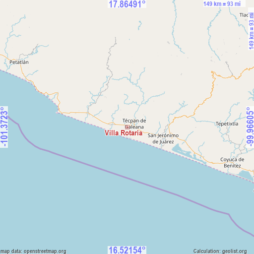
Villa Rotaria GPS coordinates[2]
17° 11' 39.984" North, 100° 40' 9.012" West
| Map corner | latitude | longitude |
|---|---|---|
| Upper-left | 17.86491°, | -101.3723° |
| Center: | 17.19444°, | -100.66917° |
| Lower-right: | 16.52154°, | -99.96605° |
| Map W x H: | 149.4×149.4 km | = 92.8×92.8mi |
| max Lat: | 32.7° ⇑86.6% North |
| Villa Rotaria: | 17.19444° |
| min Lat: | ⇓13.4% South 14.53588° |
| min Long | Villa Rotaria | max Long |
| -117.105° | -100.66917° | -86.73105° |
| W 29.2%⇐ | ⇒70.8% E |
Elevation
Elevation of Villa Rotaria is 23 m = 75 ft, and this is 1230.7 m = 4038 ft below average elevation for this country.
| Max E: |
3497 m = 11473 ft | 90.4% |
| Avg. | 1253.7 m = 4113 ft | |
| Villa Rotaria | 23 m = 75 ft | |
Min E: |
-1 m = -3 ft | 9.6% |
See also: Mexico elevation on elevation.city.
Geographical zone
Villa Rotaria is located in North Torrid zone (between Equator and Tropic of Cancer). Distance of this Northern Tropic circle is 694.1 km =431.3 mi to North.| Distance of | km | miles | from Villa Rotaria |
|---|---|---|---|
| North Pole | 8095.2 | 5030.1 | to North |
| Arctic Circle | 5489.3 | 3410.9 | to North |
| Tropic Cancer | 694.1 | 431.3 | to North |
| Equator | 1911.8 | 1187.9 | to South |


Nearby cities:
15 places around Villa Rotaria: (largest is in red/bold)
• Arenal de Gómez (Primer Arenal)
23.3 km =14.5 mi,  105°
105°
• Arenal del Centro (La Máquina)
23.3 km =14.5 mi, 106°
• Colonia Veinte de Noviembre (El Veinte)
12.9 km =8 mi,  280°
280°
• Corral Falso
22.3 km =13.9 mi,  96°
96°
• El Súchil
4.8 km =3 mi,  41°
41°
• Hacienda de Cabañas
23.6 km =14.7 mi,  117°
117°
• Las Tunas
21.4 km =13.3 mi, 112°
• Nuxco
9.4 km =5.8 mi, 280°
• Rodecia
3.6 km =2.2 mi,  293°
293°
• San Jerónimo de Juárez
22 km =13.7 mi, 106°
• San Luis San Pedro
23.8 km =14.8 mi, 289°
• Santa María
11.1 km =6.9 mi,  69°
69°
• Tenexpa
1.1 km =0.7 mi,  189°
189°
• Tetitlán
5 km =3.1 mi,  141°
141°
• Técpan de Galeana
5 km =3.1 mi,  55°
55°
Sources, notices
• [Note1] Compared only with cities in Mexico existing in our database
• [Src1] Map data: © OpenStreetMap contributors (CC-BY-SA)
• [Src2] Other city data from geonames.org with taken over terms of usage.
• [Src3] Geographical zone / Annual Mean Temperature by Robert A. Rohde @ Wikipedia
