San Antonio el Paso geodata
San Antonio el Paso (Hidalgo) is a populated place; located in Mexico in America/Mexico_City (GMT-6) time zone. With population of 1,348 people, there are 6455 cities with bigger population in this country. Compared to other cities in Mexico, 60.2% of cities are located further ↓South; 55.9% of cities are located further ←West and 95.7% of cities have lower elevation than San Antonio el Paso. Note1


San Antonio el Paso GPS coordinates[2]
20° 8' 49.992" North, 98° 36' 57.996" West
| Map corner | latitude | longitude |
|---|---|---|
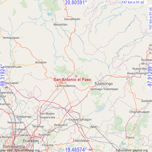
| Upper-left | 20.80591°, | -99.31924° |
| Center: | 20.14722°, | -98.61611° |
| Lower-right: | 19.48574°, | -97.91299° |
| Map W x H: | 146.8×146.8 km | = 91.2×91.2mi |
| max Lat: | 32.7° ⇑39.8% North |
| San Antonio el Paso: | 20.14722° |
| min Lat: | ⇓60.2% South 14.53588° |
| min Long | San Antonio el | max Long |
| -117.105° | -98.61611° | -86.73105° |
| W 55.9%⇐ | ⇒44.1% E |
Elevation
Elevation of San Antonio el Paso is 2614 m = 8576 ft, and this is 1360.3 m = 4463 ft above average elevation for this country.
| Max E: |
3497 m = 11473 ft | 4.3% |
| San Antonio el Paso | 2614 m 8576 ft | |
| Avg. | 1253.7 m = 4113 ft | |
Min E: |
-1 m = -3 ft | 95.7% |
See also: Mexico elevation on elevation.city.
Geographical zone
San Antonio el Paso is located in North Torrid zone (between Equator and Tropic of Cancer). Distance of this Northern Tropic circle is 365.8 km =227.3 mi to North.| Distance of | km | miles | from San Antonio el Paso |
|---|---|---|---|
| North Pole | 7766.9 | 4826.1 | to North |
| Arctic Circle | 5161 | 3206.9 | to North |
| Tropic Cancer | 365.8 | 227.3 | to North |
| Equator | 2240.2 | 1392 | to South |


Nearby cities:
15 places around San Antonio el Paso: (largest is in red/bold)
• Colonia Militar
9.9 km =6.2 mi,  246°
246°
• Huasca de Ocampo
7.5 km =4.7 mi,  33°
33°
• La Loma
8.3 km =5.2 mi, 25°
• Mineral del Monte
6.1 km =3.8 mi,  260°
260°
• Omitlán de Juárez
4.2 km =2.6 mi,  306°
306°
• Privada del Álamo
10.3 km =6.4 mi,  238°
238°
• Pueblo Nuevo
8.3 km =5.2 mi,  290°
290°
• San Guillermo la Reforma
9.1 km =5.7 mi, 250°
• San José Ocotillos
6.6 km =4.1 mi,  2°
2°
• San Miguel Regla
9.9 km =6.2 mi,  35°
35°
• Santo Tomás Allende
9.5 km =5.9 mi,  358°
358°
• Tezoantla
4.3 km =2.7 mi, 235°
• Velasco
4.1 km =2.5 mi,  321°
321°
• Venta de Guadalupe
8.3 km =5.2 mi,  341°
341°
• Xolostitla de Morelos (Xolostitla)
9.3 km =5.8 mi,  194°
194°
Sources, notices
• [Note1] Compared only with cities in Mexico existing in our database
• [Src1] Map data: © OpenStreetMap contributors (CC-BY-SA)
• [Src2] Other city data from geonames.org with taken over terms of usage.
• [Src3] Geographical zone / Annual Mean Temperature by Robert A. Rohde @ Wikipedia
