El Pozo geodata
El Pozo (Querétaro) is a populated place; located in Mexico in America/Mexico_City (GMT-6) time zone. With population of 1,220 people, there are 7122 cities with bigger population in this country. Compared to other cities in Mexico, 70.7% of cities are located further ↓South; 67.7% of cities are located further →East and 70.7% of cities have lower elevation than El Pozo. Note1


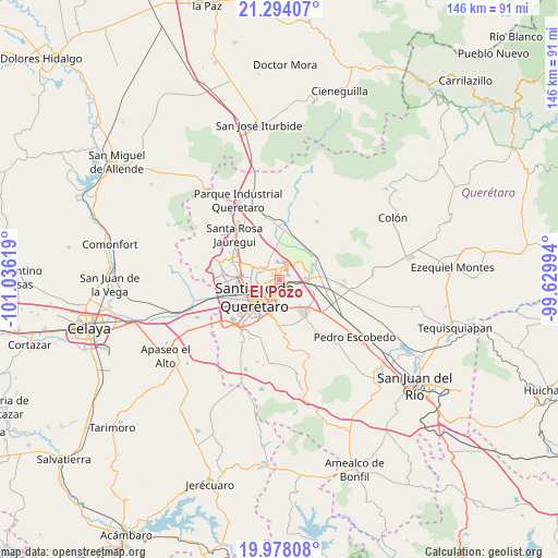
El Pozo GPS coordinates[2]
20° 38' 15" North, 100° 19' 59.016" West
| Map corner | latitude | longitude |
|---|---|---|
| Upper-left | 21.29407°, | -101.03619° |
| Center: | 20.6375°, | -100.33306° |
| Lower-right: | 19.97808°, | -99.62994° |
| Map W x H: | 146.3×146.3 km | = 90.9×90.9mi |
| max Lat: | 32.7° ⇑29.3% North |
| El Pozo: | 20.6375° |
| min Lat: | ⇓70.7% South 14.53588° |
| min Long | El Pozo | max Long |
| -117.105° | -100.33306° | -86.73105° |
| W 32.3%⇐ | ⇒67.7% E |
Elevation
Elevation of El Pozo is 1939 m = 6362 ft, and this is 685.3 m = 2248 ft above average elevation for this country.
| Max E: |
3497 m = 11473 ft | 29.3% |
| El Pozo | 1939 m 6362 ft | |
| Avg. | 1253.7 m = 4113 ft | |
Min E: |
-1 m = -3 ft | 70.7% |
See also: Mexico elevation on elevation.city.
Geographical zone
El Pozo is located in North Torrid zone (between Equator and Tropic of Cancer). Distance of this Northern Tropic circle is 311.2 km =193.4 mi to North.| Distance of | km | miles | from El Pozo |
|---|---|---|---|
| North Pole | 7712.4 | 4792.3 | to North |
| Arctic Circle | 5106.5 | 3173 | to North |
| Tropic Cancer | 311.2 | 193.4 | to North |
| Equator | 2294.7 | 1425.9 | to South |


Nearby cities:
15 places around El Pozo: (largest is in red/bold)
• Cerro Prieto
4.6 km =2.9 mi,  73°
73°
• Fraccionamiento del Parque Residencial
5.9 km =3.7 mi,  183°
183°
• Fray Junípero Serra [Fraccionamiento]
4.6 km =2.9 mi,  302°
302°
• Hacienda la Cruz [Fraccionamiento]
7.3 km =4.5 mi,  93°
93°
• La Cañada
3.3 km =2.1 mi, 179°
• La Pradera
2.6 km =1.6 mi,  338°
338°
• La Purísima
2 km =1.2 mi,  243°
243°
• La Trinidad
4 km =2.5 mi,  96°
96°
• Lomas de Menchaca
5.3 km =3.3 mi,  269°
269°
• Ninguno [CERESO]
4.9 km =3 mi,  324°
324°
• Paseos del Pedregal
7.4 km =4.6 mi,  293°
293°
• Saldarriaga
4.3 km =2.7 mi, 104°
• San Isidro Miranda
7.5 km =4.7 mi,  173°
173°
• San José el Alto
5.4 km =3.4 mi, 289°
• Segundo Barrio de Dolores
3.7 km =2.3 mi,  157°
157°
Sources, notices
• [Note1] Compared only with cities in Mexico existing in our database
• [Src1] Map data: © OpenStreetMap contributors (CC-BY-SA)
• [Src2] Other city data from geonames.org with taken over terms of usage.
• [Src3] Geographical zone / Annual Mean Temperature by Robert A. Rohde @ Wikipedia
