Lomas de Menchaca geodata
Lomas de Menchaca (Querétaro) is a populated place; located in Mexico in America/Mexico_City (GMT-6) time zone. With population of 611 people, there are 14112 cities with bigger population in this country. Compared to other cities in Mexico, 70.7% of cities are located further ↓South; 68.3% of cities are located further →East and 72.4% of cities have lower elevation than Lomas de Menchaca. Note1


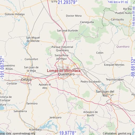
Lomas de Menchaca GPS coordinates[2]
20° 38' 13.992" North, 100° 23' 3.984" West
| Map corner | latitude | longitude |
|---|---|---|
| Upper-left | 21.29379°, | -101.08757° |
| Center: | 20.63722°, | -100.38444° |
| Lower-right: | 19.9778°, | -99.68132° |
| Map W x H: | 146.3×146.3 km | = 90.9×90.9mi |
| max Lat: | 32.7° ⇑29.3% North |
| Lomas de Menchaca: | 20.63722° |
| min Lat: | ⇓70.7% South 14.53588° |
| min Long | Lomas de Mencha | max Long |
| -117.105° | -100.38444° | -86.73105° |
| W 31.7%⇐ | ⇒68.3% E |
Elevation
Elevation of Lomas de Menchaca is 1975 m = 6480 ft, and this is 721.3 m = 2366 ft above average elevation for this country.
| Max E: |
3497 m = 11473 ft | 27.6% |
| Lomas de Menchaca | 1975 m 6480 ft | |
| Avg. | 1253.7 m = 4113 ft | |
Min E: |
-1 m = -3 ft | 72.4% |
See also: Mexico elevation on elevation.city.
Geographical zone
Lomas de Menchaca is located in North Torrid zone (between Equator and Tropic of Cancer). Distance of this Northern Tropic circle is 311.3 km =193.4 mi to North.| Distance of | km | miles | from Lomas de Menchaca |
|---|---|---|---|
| North Pole | 7712.4 | 4792.3 | to North |
| Arctic Circle | 5106.5 | 3173 | to North |
| Tropic Cancer | 311.3 | 193.4 | to North |
| Equator | 2294.6 | 1425.8 | to South |


Nearby cities:
15 places around Lomas de Menchaca: (largest is in red/bold)
• Bosques de la Hacienda
3.7 km =2.3 mi,  296°
296°
• Ejido San Pablo
4.4 km =2.7 mi,  316°
316°
• El Pozo
5.3 km =3.3 mi,  89°
89°
• El Salitre
5.1 km =3.2 mi,  308°
308°
• Fray Junípero Serra [Fraccionamiento]
2.9 km =1.8 mi,  30°
30°
• La Cañada
6.3 km =3.9 mi,  121°
121°
• La Pradera
5 km =3.1 mi,  61°
61°
• La Purísima
3.7 km =2.3 mi,  103°
103°
• Ninguno [CERESO]
4.8 km =3 mi, 31°
• Paseos del Pedregal
3.3 km =2.1 mi,  334°
334°
• San José el Alto
1.8 km =1.1 mi,  7°
7°
• Santiago de Querétaro
5.5 km =3.4 mi,  183°
183°
• Sergio Villaseñor
3.9 km =2.4 mi,  282°
282°
• Tonatiú
7.5 km =4.7 mi,  247°
247°
• Villas Fontana [Fraccionamiento]
3.4 km =2.1 mi, 315°
Sources, notices
• [Note1] Compared only with cities in Mexico existing in our database
• [Src1] Map data: © OpenStreetMap contributors (CC-BY-SA)
• [Src2] Other city data from geonames.org with taken over terms of usage.
• [Src3] Geographical zone / Annual Mean Temperature by Robert A. Rohde @ Wikipedia
