Paseos del Pedregal geodata
Paseos del Pedregal (Querétaro) is a populated place; located in Mexico in America/Mexico_City (GMT-6) time zone. With population of 2,432 people, there are 3626 cities with bigger population in this country. Compared to other cities in Mexico, 71.1% of cities are located further ↓South; 68.4% of cities are located further →East and 69.9% of cities have lower elevation than Paseos del Pedregal. Note1


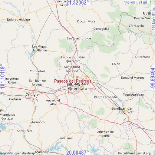
Paseos del Pedregal GPS coordinates[2]
20° 39' 51.012" North, 100° 23' 53.016" West
| Map corner | latitude | longitude |
|---|---|---|
| Upper-left | 21.32062°, | -101.10119° |
| Center: | 20.66417°, | -100.39806° |
| Lower-right: | 20.00487°, | -99.69494° |
| Map W x H: | 146.3×146.3 km | = 90.9×90.9mi |
| max Lat: | 32.7° ⇑28.9% North |
| Paseos del Pedregal: | 20.66417° |
| min Lat: | ⇓71.1% South 14.53588° |
| min Long | Paseos del Pedr | max Long |
| -117.105° | -100.39806° | -86.73105° |
| W 31.6%⇐ | ⇒68.4% E |
Elevation
Elevation of Paseos del Pedregal is 1921 m = 6302 ft, and this is 667.3 m = 2189 ft above average elevation for this country.
| Max E: |
3497 m = 11473 ft | 30.1% |
| Paseos del Pedregal | 1921 m 6302 ft | |
| Avg. | 1253.7 m = 4113 ft | |
Min E: |
-1 m = -3 ft | 69.9% |
See also: Mexico elevation on elevation.city.
Geographical zone
Paseos del Pedregal is located in North Torrid zone (between Equator and Tropic of Cancer). Distance of this Northern Tropic circle is 308.3 km =191.6 mi to North.| Distance of | km | miles | from Paseos del Pedregal |
|---|---|---|---|
| North Pole | 7709.4 | 4790.4 | to North |
| Arctic Circle | 5103.5 | 3171.2 | to North |
| Tropic Cancer | 308.3 | 191.6 | to North |
| Equator | 2297.6 | 1427.7 | to South |


Nearby cities:
15 places around Paseos del Pedregal: (largest is in red/bold)
• Bosques de la Hacienda
2.4 km =1.5 mi,  234°
234°
• Ejido San Pablo
1.6 km =1 mi,  275°
275°
• El Pozo
7.4 km =4.6 mi,  113°
113°
• El Salitre
2.6 km =1.6 mi,  274°
274°
• Fray Junípero Serra [Fraccionamiento]
3 km =1.9 mi,  99°
99°
• La Pradera
5.8 km =3.6 mi, 95°
• La Purísima
6.3 km =3.9 mi,  127°
127°
• Lomas de Menchaca
3.3 km =2.1 mi,  154°
154°
• Ninguno [CERESO]
4.1 km =2.5 mi,  75°
75°
• Rancho Largo
6.1 km =3.8 mi,  314°
314°
• San José Buenavista
8 km =5 mi,  351°
351°
• San José el Alto
2 km =1.2 mi, 125°
• Sergio Villaseñor
3.2 km =2 mi, 228°
• Tonatiú
8 km =5 mi,  223°
223°
• Villas Fontana [Fraccionamiento]
1.1 km =0.7 mi,  239°
239°
Sources, notices
• [Note1] Compared only with cities in Mexico existing in our database
• [Src1] Map data: © OpenStreetMap contributors (CC-BY-SA)
• [Src2] Other city data from geonames.org with taken over terms of usage.
• [Src3] Geographical zone / Annual Mean Temperature by Robert A. Rohde @ Wikipedia
