La Palmita y Anexos (La Presita) geodata
La Palmita y Anexos (La Presita) (Sinaloa) is a populated place; located in Mexico in America/Mazatlan (GMT-7) time zone. With population of 1,203 people, there are 7224 cities with bigger population in this country. Compared to other cities in Mexico, 91.7% of cities are located further ↓South; 94.9% of cities are located further →East and 81.5% of cities have higher elevation than La Palmita y Anexos (La Presita). Note1
Current local time in La Palmita y Anexos (La Presita):
07:33 AM, WednesdayDifference from your time zone: hours


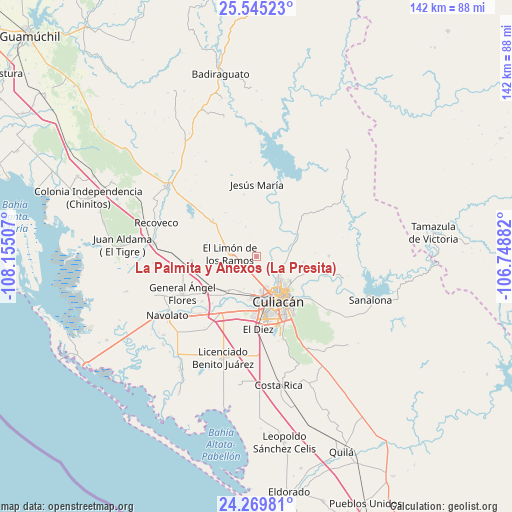
La Palmita y Anexos (La Presita) GPS coordinates[2]
24° 54' 33.012" North, 107° 27' 6.984" West
| Map corner | latitude | longitude |
|---|---|---|
| Upper-left | 25.54523°, | -108.15507° |
| Center: | 24.90917°, | -107.45194° |
| Lower-right: | 24.26981°, | -106.74882° |
| Map W x H: | 141.8×141.8 km | = 88.1×88.1mi |
| max Lat: | 32.7° ⇑8.3% North |
| La Palmita y Anexos (La Presita): | 24.90917° |
| min Lat: | ⇓91.7% South 14.53588° |
| min Long | La Palmita y An | max Long |
| -117.105° | -107.45194° | -86.73105° |
| W 5.1%⇐ | ⇒94.9% E |
Elevation
Elevation of La Palmita y Anexos (La Presita) is 76 m = 249 ft, and this is 1177.7 m = 3864 ft below average elevation for this country.
| Max E: |
3497 m = 11473 ft | 81.5% |
| Avg. | 1253.7 m = 4113 ft | |
| La Palmita y Anexos (La Presita) | 76 m = 249 ft | |
Min E: |
-1 m = -3 ft | 18.5% |
See also: Mexico elevation on elevation.city.
Geographical zone
La Palmita y Anexos (La Presita) is located in North temperate zone (between Tropic of Cancer and the Arctic Circle). Distance of this Northern Tropic circle is 163.7 km =101.7 mi to South.| Distance of | km | miles | from La Palmita y Anexos (La Presita) |
|---|---|---|---|
| North Pole | 7237.4 | 4497.1 | to North |
| Arctic Circle | 4631.5 | 2877.9 | to North |
| Tropic Cancer | 163.7 | 101.7 | to South |
| Equator | 2769.6 | 1720.9 | to South |


Nearby cities:
15 places around La Palmita y Anexos (La Presita): (largest is in red/bold)
• Adolfo López Mateos (El Tamarindo)
18.3 km =11.4 mi,  265°
265°
• Agua Caliente de los Monzón
7.2 km =4.5 mi,  67°
67°
• Bacurimí
10.8 km =6.7 mi,  180°
180°
• Bellavista
10.7 km =6.6 mi,  185°
185°
• Campo Lo de Beltrán
19.3 km =12 mi,  237°
237°
• Cofradía de San Pedro
19.6 km =12.2 mi,  230°
230°
• Culiacancito
12.5 km =7.8 mi,  221°
221°
• Culiacán
14.7 km =9.1 mi,  153°
153°
• El Limón de los Ramos
7.2 km =4.5 mi, 273°
• El Ranchito
19.7 km =12.2 mi,  157°
157°
• El Tepuche
11 km =6.8 mi, 69°
• Estación Rosales
15.2 km =9.4 mi, 238°
• La Bebelama de San Pedro
17.8 km =11.1 mi, 223°
• La Campana
16 km =9.9 mi,  310°
310°
• La Limita de Itaje
13.8 km =8.6 mi,  136°
136°
Sources, notices
• [Note1] Compared only with cities in Mexico existing in our database
• [Src1] Map data: © OpenStreetMap contributors (CC-BY-SA)
• [Src2] Other city data from geonames.org with taken over terms of usage.
• [Src3] Geographical zone / Annual Mean Temperature by Robert A. Rohde @ Wikipedia
