Playa de la Libertad geodata
Playa de la Libertad (Veracruz) is a populated place; located in Mexico in America/Mexico_City (GMT-6) time zone. With population of 1,192 people, there are 7287 cities with bigger population in this country. Compared to other cities in Mexico, 63.3% of cities are located further ↑North; 81.8% of cities are located further ←West and 91.2% of cities have higher elevation than Playa de la Libertad. Note1


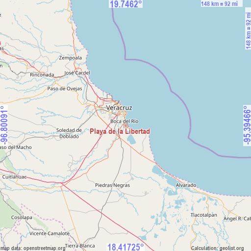
Playa de la Libertad GPS coordinates[2]
19° 4' 59.016" North, 96° 5' 52.008" West
| Map corner | latitude | longitude |
|---|---|---|
| Upper-left | 19.7462°, | -96.80091° |
| Center: | 19.08306°, | -96.09778° |
| Lower-right: | 18.41725°, | -95.39466° |
| Map W x H: | 147.8×147.8 km | = 91.8×91.8mi |
| max Lat: | 32.7° ⇑63.3% North |
| Playa de la Libertad: | 19.08306° |
| min Lat: | ⇓36.7% South 14.53588° |
| min Long | Playa de la Lib | max Long |
| -117.105° | -96.09778° | -86.73105° |
| W 81.8%⇐ | ⇒18.2% E |
Elevation
Elevation of Playa de la Libertad is 21 m = 69 ft, and this is 1232.7 m = 4044 ft below average elevation for this country.
| Max E: |
3497 m = 11473 ft | 91.2% |
| Avg. | 1253.7 m = 4113 ft | |
| Playa de la Libertad | 21 m = 69 ft | |
Min E: |
-1 m = -3 ft | 8.8% |
See also: Mexico elevation on elevation.city.
Geographical zone
Playa de la Libertad is located in North Torrid zone (between Equator and Tropic of Cancer). Distance of this Northern Tropic circle is 484.1 km =300.8 mi to North.| Distance of | km | miles | from Playa de la Libertad |
|---|---|---|---|
| North Pole | 7885.2 | 4899.6 | to North |
| Arctic Circle | 5279.3 | 3280.4 | to North |
| Tropic Cancer | 484.1 | 300.8 | to North |
| Equator | 2121.8 | 1318.4 | to South |


Nearby cities:
15 places around Playa de la Libertad: (largest is in red/bold)
• Antón Lizardo
11.3 km =7 mi,  103°
103°
• Boca del Rio
2.5 km =1.6 mi,  344°
344°
• Colonia Lázaro Cárdenas
7.9 km =4.9 mi,  245°
245°
• El Tejar
6.7 km =4.2 mi,  261°
261°
• Fraccionamiento Arboledas San Ramón
6.3 km =3.9 mi,  281°
281°
• Fraccionamiento las Lomas
1.4 km =0.9 mi,  177°
177°
• Hacienda Sotavento
10.4 km =6.5 mi,  302°
302°
• Herón Proal
7.8 km =4.8 mi, 179°
• Juan de Alfaro
9.9 km =6.2 mi,  218°
218°
• La Gloria
7.7 km =4.8 mi,  199°
199°
• La Laguna y Monte del Castillo
11.3 km =7 mi,  169°
169°
• Medellín de Bravo
6.9 km =4.3 mi, 246°
• Paso Colorado
4.6 km =2.9 mi,  244°
244°
• Paso del Toro
6.7 km =4.2 mi, 216°
• Rancho del Padre
8.1 km =5 mi, 256°
Sources, notices
• [Note1] Compared only with cities in Mexico existing in our database
• [Src1] Map data: © OpenStreetMap contributors (CC-BY-SA)
• [Src2] Other city data from geonames.org with taken over terms of usage.
• [Src3] Geographical zone / Annual Mean Temperature by Robert A. Rohde @ Wikipedia
