La Gloria geodata
La Gloria (Veracruz) is a populated place; located in Mexico in America/Mexico_City (GMT-6) time zone. With population of 600 people, there are 14337 cities with bigger population in this country. Compared to other cities in Mexico, 64.4% of cities are located further ↑North; 81.8% of cities are located further ←West and 92.1% of cities have higher elevation than La Gloria. Note1


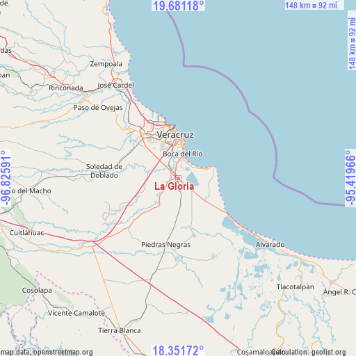
La Gloria GPS coordinates[2]
19° 1' 4.008" North, 96° 7' 22.008" West
| Map corner | latitude | longitude |
|---|---|---|
| Upper-left | 19.68118°, | -96.82591° |
| Center: | 19.01778°, | -96.12278° |
| Lower-right: | 18.35172°, | -95.41966° |
| Map W x H: | 147.8×147.8 km | = 91.8×91.8mi |
| max Lat: | 32.7° ⇑64.4% North |
| La Gloria: | 19.01778° |
| min Lat: | ⇓35.6% South 14.53588° |
| min Long | La Gloria | max Long |
| -117.105° | -96.12278° | -86.73105° |
| W 81.8%⇐ | ⇒18.2% E |
Elevation
Elevation of La Gloria is 19 m = 62 ft, and this is 1234.7 m = 4051 ft below average elevation for this country.
| Max E: |
3497 m = 11473 ft | 92.1% |
| Avg. | 1253.7 m = 4113 ft | |
| La Gloria | 19 m = 62 ft | |
Min E: |
-1 m = -3 ft | 7.9% |
See also: Mexico elevation on elevation.city.
Geographical zone
La Gloria is located in North Torrid zone (between Equator and Tropic of Cancer). Distance of this Northern Tropic circle is 491.3 km =305.3 mi to North.| Distance of | km | miles | from La Gloria |
|---|---|---|---|
| North Pole | 7892.5 | 4904.2 | to North |
| Arctic Circle | 5286.6 | 3284.9 | to North |
| Tropic Cancer | 491.3 | 305.3 | to North |
| Equator | 2114.6 | 1314 | to South |


Nearby cities:
15 places around La Gloria: (largest is in red/bold)
• Boca del Rio
9.9 km =6.2 mi,  11°
11°
• Colonia Lázaro Cárdenas
6 km =3.7 mi,  311°
311°
• El Tejar
7.5 km =4.7 mi,  327°
327°
• Fraccionamiento Arboledas San Ramón
9.2 km =5.7 mi,  337°
337°
• Fraccionamiento las Lomas
6.4 km =4 mi,  24°
24°
• Herón Proal
2.7 km =1.7 mi,  101°
101°
• Juan de Alfaro
3.6 km =2.2 mi,  262°
262°
• La Laguna y Monte del Castillo
6.1 km =3.8 mi,  129°
129°
• Las Puertas
9.3 km =5.8 mi,  287°
287°
• Los Robles
5 km =3.1 mi,  173°
173°
• Medellín de Bravo
5.9 km =3.7 mi,  321°
321°
• Paso Colorado
5.5 km =3.4 mi, 344°
• Paso del Toro
2.3 km =1.4 mi, 324°
• Playa de la Libertad
7.7 km =4.8 mi, 19°
• Rancho del Padre
7.5 km =4.7 mi, 315°
Sources, notices
• [Note1] Compared only with cities in Mexico existing in our database
• [Src1] Map data: © OpenStreetMap contributors (CC-BY-SA)
• [Src2] Other city data from geonames.org with taken over terms of usage.
• [Src3] Geographical zone / Annual Mean Temperature by Robert A. Rohde @ Wikipedia
