Rancho del Padre geodata
Rancho del Padre (Veracruz) is a populated place; located in Mexico in America/Mexico_City (GMT-6) time zone. With population of 1,215 people, there are 7154 cities with bigger population in this country. Compared to other cities in Mexico, 63.6% of cities are located further ↑North; 81.5% of cities are located further ←West and 91.6% of cities have higher elevation than Rancho del Padre. Note1


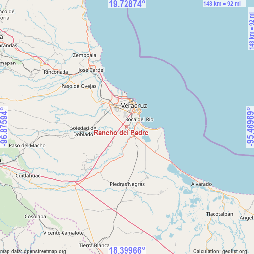
Rancho del Padre GPS coordinates[2]
19° 3' 55.908" North, 96° 10' 22.116" West
| Map corner | latitude | longitude |
|---|---|---|
| Upper-left | 19.72874°, | -96.87594° |
| Center: | 19.06553°, | -96.17281° |
| Lower-right: | 18.39966°, | -95.46969° |
| Map W x H: | 147.8×147.8 km | = 91.8×91.8mi |
| max Lat: | 32.7° ⇑63.6% North |
| Rancho del Padre: | 19.06553° |
| min Lat: | ⇓36.4% South 14.53588° |
| min Long | Rancho del Padr | max Long |
| -117.105° | -96.17281° | -86.73105° |
| W 81.5%⇐ | ⇒18.5% E |
Elevation
Elevation of Rancho del Padre is 20 m = 66 ft, and this is 1233.7 m = 4048 ft below average elevation for this country.
| Max E: |
3497 m = 11473 ft | 91.6% |
| Avg. | 1253.7 m = 4113 ft | |
| Rancho del Padre | 20 m = 66 ft | |
Min E: |
-1 m = -3 ft | 8.4% |
See also: Mexico elevation on elevation.city.
Geographical zone
Rancho del Padre is located in North Torrid zone (between Equator and Tropic of Cancer). Distance of this Northern Tropic circle is 486 km =302 mi to North.| Distance of | km | miles | from Rancho del Padre |
|---|---|---|---|
| North Pole | 7887.2 | 4900.9 | to North |
| Arctic Circle | 5281.3 | 3281.6 | to North |
| Tropic Cancer | 486 | 302 | to North |
| Equator | 2119.9 | 1317.2 | to South |


Nearby cities:
15 places around Rancho del Padre: (largest is in red/bold)
• Boca del Rio
8.4 km =5.2 mi,  58°
58°
• Colonia Lázaro Cárdenas
1.5 km =0.9 mi,  151°
151°
• El Tejar
1.6 km =1 mi,  51°
51°
• Fraccionamiento Arboledas San Ramón
3.6 km =2.2 mi,  28°
28°
• Fraccionamiento las Lomas
8 km =5 mi,  86°
86°
• Hacienda Sotavento
7.6 km =4.7 mi,  353°
353°
• Jamapa
7.7 km =4.8 mi,  249°
249°
• Juan de Alfaro
6 km =3.7 mi,  164°
164°
• La Gloria
7.5 km =4.7 mi,  135°
135°
• Las Puertas
4.4 km =2.7 mi,  234°
234°
• Medellín de Bravo
1.8 km =1.1 mi,  115°
115°
• Paso Colorado
3.7 km =2.3 mi, 89°
• Paso del Toro
5.2 km =3.2 mi,  130°
130°
• Playa de la Libertad
8.1 km =5 mi,  76°
76°
• Valle Alto
8.4 km =5.2 mi,  324°
324°
Sources, notices
• [Note1] Compared only with cities in Mexico existing in our database
• [Src1] Map data: © OpenStreetMap contributors (CC-BY-SA)
• [Src2] Other city data from geonames.org with taken over terms of usage.
• [Src3] Geographical zone / Annual Mean Temperature by Robert A. Rohde @ Wikipedia
