Octeyuco Dos Mil geodata
Octeyuco Dos Mil (State of Mexico) is a populated place; located in Mexico in America/Mexico_City (GMT-6) time zone. With population of 1,158 people, there are 7487 cities with bigger population in this country. Compared to other cities in Mexico, 56.3% of cities are located further ↓South; 58.3% of cities are located further →East and 96.5% of cities have lower elevation than Octeyuco Dos Mil. Note1


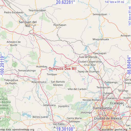
Octeyuco Dos Mil GPS coordinates[2]
19° 57' 47.988" North, 99° 35' 17.016" West
| Map corner | latitude | longitude |
|---|---|---|
| Upper-left | 20.62281°, | -100.29119° |
| Center: | 19.96333°, | -99.58806° |
| Lower-right: | 19.30108°, | -98.88494° |
| Map W x H: | 147×147 km | = 91.3×91.3mi |
| max Lat: | 32.7° ⇑43.7% North |
| Octeyuco Dos Mil: | 19.96333° |
| min Lat: | ⇓56.3% South 14.53588° |
| min Long | Octeyuco Dos Mi | max Long |
| -117.105° | -99.58806° | -86.73105° |
| W 41.7%⇐ | ⇒58.3% E |
Elevation
Elevation of Octeyuco Dos Mil is 2651 m = 8698 ft, and this is 1397.3 m = 4584 ft above average elevation for this country.
| Max E: |
3497 m = 11473 ft | 3.5% |
| Octeyuco Dos Mil | 2651 m 8698 ft | |
| Avg. | 1253.7 m = 4113 ft | |
Min E: |
-1 m = -3 ft | 96.5% |
See also: Mexico elevation on elevation.city.
Geographical zone
Octeyuco Dos Mil is located in North Torrid zone (between Equator and Tropic of Cancer). Distance of this Northern Tropic circle is 386.2 km =240 mi to North.| Distance of | km | miles | from Octeyuco Dos Mil |
|---|---|---|---|
| North Pole | 7787.3 | 4838.8 | to North |
| Arctic Circle | 5181.5 | 3219.6 | to North |
| Tropic Cancer | 386.2 | 240 | to North |
| Equator | 2219.7 | 1379.3 | to South |


Nearby cities:
15 places around Octeyuco Dos Mil: (largest is in red/bold)
• Agua Escondida
2 km =1.2 mi,  30°
30°
• Canalejas
2.5 km =1.6 mi,  313°
313°
• Ejido de Coscomate del Progreso
5.4 km =3.4 mi,  127°
127°
• El Barrete
3.2 km =2 mi,  287°
287°
• El Durazno de Cuauhtémoc
5.9 km =3.7 mi,  197°
197°
• El Magueyal
2.7 km =1.7 mi,  148°
148°
• El Rincón
6.6 km =4.1 mi,  264°
264°
• Jilotepec de Molina Enríquez
5.9 km =3.7 mi,  102°
102°
• La Comunidad
6.5 km =4 mi,  10°
10°
• Las Huertas
3.5 km =2.2 mi,  73°
73°
• Las Manzanas
3.1 km =1.9 mi,  116°
116°
• Magueycitos
5 km =3.1 mi,  249°
249°
• San Lorenzo Octeyuco
1.4 km =0.9 mi, 260°
• Xhitey
6.6 km =4.1 mi, 72°
• Xhixhata
4.5 km =2.8 mi,  79°
79°
Sources, notices
• [Note1] Compared only with cities in Mexico existing in our database
• [Src1] Map data: © OpenStreetMap contributors (CC-BY-SA)
• [Src2] Other city data from geonames.org with taken over terms of usage.
• [Src3] Geographical zone / Annual Mean Temperature by Robert A. Rohde @ Wikipedia
