El Durazno de Cuauhtémoc geodata
El Durazno de Cuauhtémoc (State of Mexico) is a populated place; located in Mexico in America/Mexico_City (GMT-6) time zone. With population of 965 people, there are 9018 cities with bigger population in this country. Compared to other cities in Mexico, 55.4% of cities are located further ↓South; 58.7% of cities are located further →East and 95.1% of cities have lower elevation than El Durazno de Cuauhtémoc. Note1
Current local time in El Durazno de Cuauhtémoc:
11:18 AM, MondayDifference from your time zone: hours


El Durazno de Cuauhtémoc GPS coordinates[2]
19° 54' 46.98" North, 99° 36' 19.116" West
| Map corner | latitude | longitude |
|---|---|---|
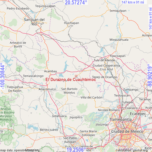
| Upper-left | 20.57274°, | -100.30844° |
| Center: | 19.91305°, | -99.60531° |
| Lower-right: | 19.2506°, | -98.90219° |
| Map W x H: | 147×147 km | = 91.3×91.3mi |
| max Lat: | 32.7° ⇑44.6% North |
| El Durazno de Cuauhtémoc: | 19.91305° |
| min Lat: | ⇓55.4% South 14.53588° |
| min Long | El Durazno de C | max Long |
| -117.105° | -99.60531° | -86.73105° |
| W 41.3%⇐ | ⇒58.7% E |
Elevation
Elevation of El Durazno de Cuauhtémoc is 2598 m = 8524 ft, and this is 1344.3 m = 4410 ft above average elevation for this country.
| Max E: |
3497 m = 11473 ft | 4.9% |
| El Durazno de Cuauhtémoc | 2598 m 8524 ft | |
| Avg. | 1253.7 m = 4113 ft | |
Min E: |
-1 m = -3 ft | 95.1% |
See also: Mexico elevation on elevation.city.
Geographical zone
El Durazno de Cuauhtémoc is located in North Torrid zone (between Equator and Tropic of Cancer). Distance of this Northern Tropic circle is 391.8 km =243.5 mi to North.| Distance of | km | miles | from El Durazno de Cuauhtémoc |
|---|---|---|---|
| North Pole | 7792.9 | 4842.3 | to North |
| Arctic Circle | 5187.1 | 3223.1 | to North |
| Tropic Cancer | 391.8 | 243.5 | to North |
| Equator | 2214.1 | 1375.8 | to South |


Nearby cities:
15 places around El Durazno de Cuauhtémoc: (largest is in red/bold)
• Denjhi
7.3 km =4.5 mi,  82°
82°
• Doxhicho
5.2 km =3.2 mi,  106°
106°
• Ejido de Coscomate del Progreso
6.5 km =4 mi,  69°
69°
• El Barrete
6.7 km =4.2 mi,  349°
349°
• El Magueyal
4.6 km =2.9 mi,  44°
44°
• El Puerto
6.2 km =3.9 mi,  232°
232°
• El Rincón
6.9 km =4.3 mi,  315°
315°
• Las Manzanas
6.2 km =3.9 mi,  47°
47°
• Magueycitos
4.8 km =3 mi, 323°
• Octeyuco Dos Mil
5.9 km =3.7 mi,  17°
17°
• San Felipe Coamango
6 km =3.7 mi,  181°
181°
• San Gabriel
5 km =3.1 mi,  237°
237°
• San Juan Tuxtepec
6.7 km =4.2 mi,  205°
205°
• San Lorenzo Octeyuco
5.4 km =3.4 mi,  4°
4°
• Xhimojay
4 km =2.5 mi,  283°
283°
Sources, notices
• [Note1] Compared only with cities in Mexico existing in our database
• [Src1] Map data: © OpenStreetMap contributors (CC-BY-SA)
• [Src2] Other city data from geonames.org with taken over terms of usage.
• [Src3] Geographical zone / Annual Mean Temperature by Robert A. Rohde @ Wikipedia
