Agua Escondida geodata
Agua Escondida (State of Mexico) is a populated place; located in Mexico in America/Mexico_City (GMT-6) time zone. With population of 2,476 people, there are 3572 cities with bigger population in this country. Compared to other cities in Mexico, 56.6% of cities are located further ↓South; 58.1% of cities are located further →East and 96.3% of cities have lower elevation than Agua Escondida. Note1


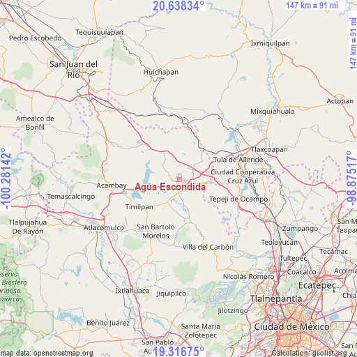
Agua Escondida GPS coordinates[2]
19° 58' 44.148" North, 99° 34' 41.844" West
| Map corner | latitude | longitude |
|---|---|---|
| Upper-left | 20.63834°, | -100.28142° |
| Center: | 19.97893°, | -99.57829° |
| Lower-right: | 19.31675°, | -98.87517° |
| Map W x H: | 146.9×146.9 km | = 91.3×91.3mi |
| max Lat: | 32.7° ⇑43.4% North |
| Agua Escondida: | 19.97893° |
| min Lat: | ⇓56.6% South 14.53588° |
| min Long | Agua Escondida | max Long |
| -117.105° | -99.57829° | -86.73105° |
| W 41.9%⇐ | ⇒58.1% E |
Elevation
Elevation of Agua Escondida is 2642 m = 8668 ft, and this is 1388.3 m = 4555 ft above average elevation for this country.
| Max E: |
3497 m = 11473 ft | 3.7% |
| Agua Escondida | 2642 m 8668 ft | |
| Avg. | 1253.7 m = 4113 ft | |
Min E: |
-1 m = -3 ft | 96.3% |
See also: Mexico elevation on elevation.city.
Geographical zone
Agua Escondida is located in North Torrid zone (between Equator and Tropic of Cancer). Distance of this Northern Tropic circle is 384.5 km =238.9 mi to North.| Distance of | km | miles | from Agua Escondida |
|---|---|---|---|
| North Pole | 7785.6 | 4837.7 | to North |
| Arctic Circle | 5179.7 | 3218.5 | to North |
| Tropic Cancer | 384.5 | 238.9 | to North |
| Equator | 2221.4 | 1380.3 | to South |


Nearby cities:
15 places around Agua Escondida: (largest is in red/bold)
• Canalejas
2.8 km =1.7 mi,  269°
269°
• Denjhi
7.8 km =4.8 mi,  145°
145°
• Ejido de Coscomate del Progreso
6 km =3.7 mi, 147°
• El Barrete
4.1 km =2.5 mi,  259°
259°
• El Magueyal
4.1 km =2.5 mi,  174°
174°
• Jilotepec de Molina Enríquez
5.6 km =3.5 mi,  122°
122°
• La Comunidad
4.7 km =2.9 mi,  2°
2°
• Las Huertas
2.4 km =1.5 mi,  107°
107°
• Las Manzanas
3.6 km =2.2 mi, 150°
• Magueycitos
6.7 km =4.2 mi,  238°
238°
• Octeyuco Dos Mil
2 km =1.2 mi,  210°
210°
• San Lorenzo Octeyuco
3.1 km =1.9 mi,  230°
230°
• Soyaniquilpan
6.4 km =4 mi,  51°
51°
• Xhitey
5.3 km =3.3 mi,  86°
86°
• Xhixhata
3.5 km =2.2 mi, 105°
Sources, notices
• [Note1] Compared only with cities in Mexico existing in our database
• [Src1] Map data: © OpenStreetMap contributors (CC-BY-SA)
• [Src2] Other city data from geonames.org with taken over terms of usage.
• [Src3] Geographical zone / Annual Mean Temperature by Robert A. Rohde @ Wikipedia
