Santa Fe y la Mar geodata
Santa Fe y la Mar (Oaxaca) is a populated place; located in Mexico in America/Mexico_City (GMT-6) time zone. With population of 1,115 people, there are 7795 cities with bigger population in this country. Compared to other cities in Mexico, 80.8% of cities are located further ↑North; 80.8% of cities are located further ←West and 78.4% of cities have higher elevation than Santa Fe y la Mar. Note1


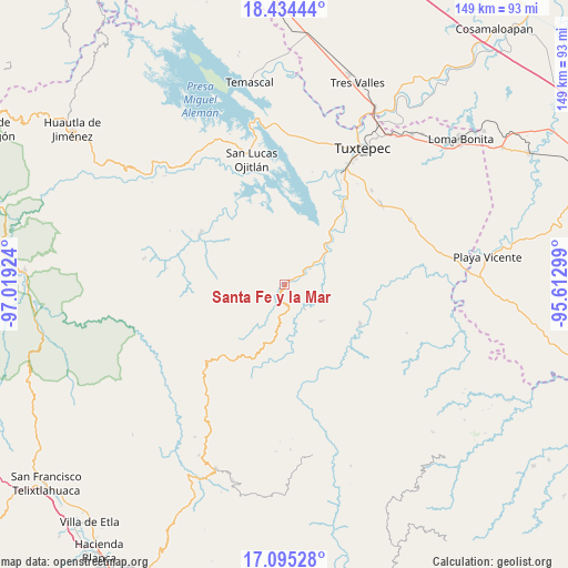
Santa Fe y la Mar GPS coordinates[2]
17° 45' 57.996" North, 96° 18' 57.996" West
| Map corner | latitude | longitude |
|---|---|---|
| Upper-left | 18.43444°, | -97.01924° |
| Center: | 17.76611°, | -96.31611° |
| Lower-right: | 17.09528°, | -95.61299° |
| Map W x H: | 148.9×148.9 km | = 92.5×92.5mi |
| max Lat: | 32.7° ⇑80.8% North |
| Santa Fe y la Mar: | 17.76611° |
| min Lat: | ⇓19.2% South 14.53588° |
| min Long | Santa Fe y la M | max Long |
| -117.105° | -96.31611° | -86.73105° |
| W 80.8%⇐ | ⇒19.2% E |
Elevation
Elevation of Santa Fe y la Mar is 122 m = 400 ft, and this is 1131.7 m = 3713 ft below average elevation for this country.
| Max E: |
3497 m = 11473 ft | 78.4% |
| Avg. | 1253.7 m = 4113 ft | |
| Santa Fe y la Mar | 122 m = 400 ft | |
Min E: |
-1 m = -3 ft | 21.6% |
See also: Mexico elevation on elevation.city.
Geographical zone
Santa Fe y la Mar is located in North Torrid zone (between Equator and Tropic of Cancer). Distance of this Northern Tropic circle is 630.5 km =391.8 mi to North.| Distance of | km | miles | from Santa Fe y la Mar |
|---|---|---|---|
| North Pole | 8031.7 | 4990.7 | to North |
| Arctic Circle | 5425.8 | 3371.4 | to North |
| Tropic Cancer | 630.5 | 391.8 | to North |
| Equator | 1975.4 | 1227.5 | to South |


Nearby cities:
15 places around Santa Fe y la Mar: (largest is in red/bold)
• Agua de Pescadito
14 km =8.7 mi,  355°
355°
• Arroyo de Banco
5.3 km =3.3 mi,  320°
320°
• Cerro Armadillo Grande
11.1 km =6.9 mi,  4°
4°
• Cerro Concha
15.3 km =9.5 mi,  60°
60°
• Cerro Marín (Monte Flor)
6 km =3.7 mi,  52°
52°
• La Gran Lucha
1.2 km =0.7 mi,  15°
15°
• La Josefina
22.1 km =13.7 mi,  123°
123°
• La Rinconada
12.5 km =7.8 mi,  94°
94°
• Paso Nuevo la Hamaca
9.6 km =6 mi, 94°
• San Isidro Chinantilla
10 km =6.2 mi, 54°
• San Pedro Ozumacín
13.7 km =8.5 mi,  135°
135°
• Santa María Jacatepec
15.3 km =9.5 mi, 46°
• Santiago Tlatepusco
21.6 km =13.4 mi,  287°
287°
• Valle Nacional
1.9 km =1.2 mi, 54°
• Vega del Sol
11.6 km =7.2 mi,  65°
65°
Sources, notices
• [Note1] Compared only with cities in Mexico existing in our database
• [Src1] Map data: © OpenStreetMap contributors (CC-BY-SA)
• [Src2] Other city data from geonames.org with taken over terms of usage.
• [Src3] Geographical zone / Annual Mean Temperature by Robert A. Rohde @ Wikipedia
