Vega del Sol geodata
Vega del Sol (Oaxaca) is a populated place; located in Mexico in America/Mexico_City (GMT-6) time zone. With population of 1,278 people, there are 6782 cities with bigger population in this country. Compared to other cities in Mexico, 80.4% of cities are located further ↑North; 81.3% of cities are located further ←West and 82.7% of cities have higher elevation than Vega del Sol. Note1


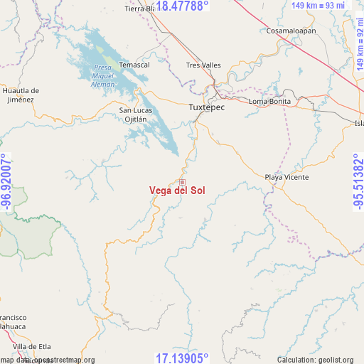
Vega del Sol GPS coordinates[2]
17° 48' 34.992" North, 96° 13' 0.984" West
| Map corner | latitude | longitude |
|---|---|---|
| Upper-left | 18.47788°, | -96.92007° |
| Center: | 17.80972°, | -96.21694° |
| Lower-right: | 17.13905°, | -95.51382° |
| Map W x H: | 148.9×148.9 km | = 92.5×92.5mi |
| max Lat: | 32.7° ⇑80.4% North |
| Vega del Sol: | 17.80972° |
| min Lat: | ⇓19.6% South 14.53588° |
| min Long | Vega del Sol | max Long |
| -117.105° | -96.21694° | -86.73105° |
| W 81.3%⇐ | ⇒18.7% E |
Elevation
Elevation of Vega del Sol is 63 m = 207 ft, and this is 1190.7 m = 3906 ft below average elevation for this country.
| Max E: |
3497 m = 11473 ft | 82.7% |
| Avg. | 1253.7 m = 4113 ft | |
| Vega del Sol | 63 m = 207 ft | |
Min E: |
-1 m = -3 ft | 17.3% |
See also: Mexico elevation on elevation.city.
Geographical zone
Vega del Sol is located in North Torrid zone (between Equator and Tropic of Cancer). Distance of this Northern Tropic circle is 625.7 km =388.8 mi to North.| Distance of | km | miles | from Vega del Sol |
|---|---|---|---|
| North Pole | 8026.8 | 4987.6 | to North |
| Arctic Circle | 5420.9 | 3368.4 | to North |
| Tropic Cancer | 625.7 | 388.8 | to North |
| Equator | 1980.3 | 1230.5 | to South |


Nearby cities:
15 places around Vega del Sol: (largest is in red/bold)
• Agua de Pescadito
14.7 km =9.1 mi,  308°
308°
• Arroyo Frijol
13 km =8.1 mi,  14°
14°
• Arroyo de Banco
13.9 km =8.6 mi,  266°
266°
• Cerro Armadillo Grande
11.6 km =7.2 mi,  302°
302°
• Cerro Concha
3.9 km =2.4 mi,  45°
45°
• Cerro Marín (Monte Flor)
5.8 km =3.6 mi,  258°
258°
• La Gran Lucha
10.8 km =6.7 mi,  250°
250°
• La Rinconada
6.1 km =3.8 mi,  161°
161°
• Paso Nuevo la Hamaca
5.6 km =3.5 mi,  189°
189°
• San Isidro Chinantilla
2.5 km =1.6 mi,  292°
292°
• San Isidro Naranjal
13 km =8.1 mi, 47°
• San Pedro Ozumacín
14.6 km =9.1 mi,  183°
183°
• Santa Fe y la Mar
11.6 km =7.2 mi, 245°
• Santa María Jacatepec
5.7 km =3.5 mi, 5°
• Valle Nacional
9.7 km =6 mi, 247°
Sources, notices
• [Note1] Compared only with cities in Mexico existing in our database
• [Src1] Map data: © OpenStreetMap contributors (CC-BY-SA)
• [Src2] Other city data from geonames.org with taken over terms of usage.
• [Src3] Geographical zone / Annual Mean Temperature by Robert A. Rohde @ Wikipedia
