Paso Nuevo la Hamaca geodata
Paso Nuevo la Hamaca (Oaxaca) is a populated place; located in Mexico in America/Mexico_City (GMT-6) time zone. With population of 773 people, there are 11306 cities with bigger population in this country. Compared to other cities in Mexico, 80.9% of cities are located further ↑North; 81.2% of cities are located further ←West and 82% of cities have higher elevation than Paso Nuevo la Hamaca. Note1
Current local time in Paso Nuevo la Hamaca:
08:33 AM, WednesdayDifference from your time zone: hours


Paso Nuevo la Hamaca GPS coordinates[2]
17° 45' 34.632" North, 96° 13' 31.332" West
| Map corner | latitude | longitude |
|---|---|---|
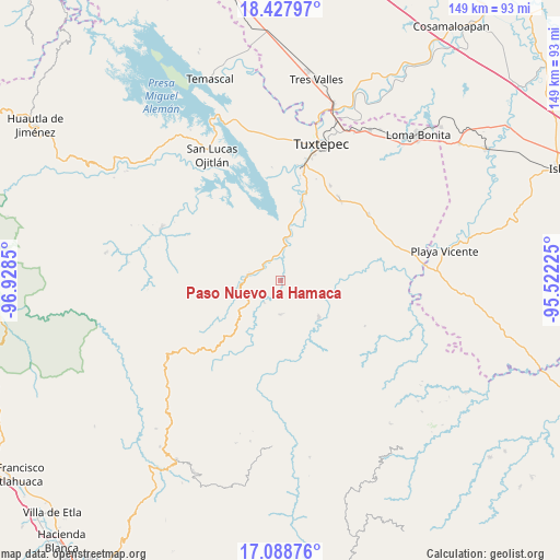
| Upper-left | 18.42797°, | -96.9285° |
| Center: | 17.75962°, | -96.22537° |
| Lower-right: | 17.08876°, | -95.52225° |
| Map W x H: | 148.9×148.9 km | = 92.5×92.5mi |
| max Lat: | 32.7° ⇑80.9% North |
| Paso Nuevo la Hamaca: | 17.75962° |
| min Lat: | ⇓19.1% South 14.53588° |
| min Long | Paso Nuevo la H | max Long |
| -117.105° | -96.22537° | -86.73105° |
| W 81.2%⇐ | ⇒18.8% E |
Elevation
Elevation of Paso Nuevo la Hamaca is 70 m = 230 ft, and this is 1183.7 m = 3884 ft below average elevation for this country.
| Max E: |
3497 m = 11473 ft | 82% |
| Avg. | 1253.7 m = 4113 ft | |
| Paso Nuevo la Hamaca | 70 m = 230 ft | |
Min E: |
-1 m = -3 ft | 18% |
See also: Mexico elevation on elevation.city.
Geographical zone
Paso Nuevo la Hamaca is located in North Torrid zone (between Equator and Tropic of Cancer). Distance of this Northern Tropic circle is 631.2 km =392.2 mi to North.| Distance of | km | miles | from Paso Nuevo la Hamaca |
|---|---|---|---|
| North Pole | 8032.4 | 4991.1 | to North |
| Arctic Circle | 5426.5 | 3371.9 | to North |
| Tropic Cancer | 631.2 | 392.2 | to North |
| Equator | 1974.7 | 1227 | to South |


Nearby cities:
15 places around Paso Nuevo la Hamaca: (largest is in red/bold)
• Arroyo de Banco
13.8 km =8.6 mi,  290°
290°
• Ayotzintepec
14.1 km =8.8 mi,  133°
133°
• Cerro Armadillo Grande
14.8 km =9.2 mi,  323°
323°
• Cerro Concha
9.1 km =5.7 mi,  23°
23°
• Cerro Marín (Monte Flor)
6.6 km =4.1 mi,  312°
312°
• La Gran Lucha
9.5 km =5.9 mi,  281°
281°
• La Josefina
14.4 km =8.9 mi,  142°
142°
• La Rinconada
2.8 km =1.7 mi,  94°
94°
• San Antonio las Palmas
17.3 km =10.7 mi,  124°
124°
• San Isidro Chinantilla
6.6 km =4.1 mi,  347°
347°
• San Pedro Ozumacín
9 km =5.6 mi,  180°
180°
• Santa Fe y la Mar
9.6 km =6 mi,  274°
274°
• Santa María Jacatepec
11.3 km =7 mi,  7°
7°
• Valle Nacional
8.3 km =5.2 mi, 282°
• Vega del Sol
5.6 km =3.5 mi, 9°
Sources, notices
• [Note1] Compared only with cities in Mexico existing in our database
• [Src1] Map data: © OpenStreetMap contributors (CC-BY-SA)
• [Src2] Other city data from geonames.org with taken over terms of usage.
• [Src3] Geographical zone / Annual Mean Temperature by Robert A. Rohde @ Wikipedia
