El Colorado geodata
El Colorado (Hidalgo) is a populated place; located in Mexico in America/Mexico_City (GMT-6) time zone. With population of 1,074 people, there are 8122 cities with bigger population in this country. Compared to other cities in Mexico, 61.7% of cities are located further ↓South; 50.1% of cities are located further ←West and 76.6% of cities have lower elevation than El Colorado. Note1


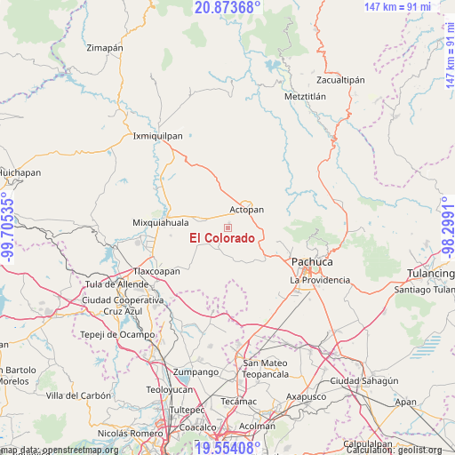
El Colorado GPS coordinates[2]
20° 12' 55.008" North, 99° 0' 7.992" West
| Map corner | latitude | longitude |
|---|---|---|
| Upper-left | 20.87368°, | -99.70535° |
| Center: | 20.21528°, | -99.00222° |
| Lower-right: | 19.55408°, | -98.2991° |
| Map W x H: | 146.7×146.7 km | = 91.2×91.2mi |
| max Lat: | 32.7° ⇑38.3% North |
| El Colorado: | 20.21528° |
| min Lat: | ⇓61.7% South 14.53588° |
| min Long | El Colorado | max Long |
| -117.105° | -99.00222° | -86.73105° |
| W 50.1%⇐ | ⇒49.9% E |
Elevation
Elevation of El Colorado is 2059 m = 6755 ft, and this is 805.3 m = 2642 ft above average elevation for this country.
| Max E: |
3497 m = 11473 ft | 23.4% |
| El Colorado | 2059 m 6755 ft | |
| Avg. | 1253.7 m = 4113 ft | |
Min E: |
-1 m = -3 ft | 76.6% |
See also: Mexico elevation on elevation.city.
Geographical zone
El Colorado is located in North Torrid zone (between Equator and Tropic of Cancer). Distance of this Northern Tropic circle is 358.2 km =222.6 mi to North.| Distance of | km | miles | from El Colorado |
|---|---|---|---|
| North Pole | 7759.3 | 4821.4 | to North |
| Arctic Circle | 5153.4 | 3202.2 | to North |
| Tropic Cancer | 358.2 | 222.6 | to North |
| Equator | 2247.7 | 1396.7 | to South |


Nearby cities:
15 places around El Colorado: (largest is in red/bold)
• Bocaja
6.1 km =3.8 mi,  353°
353°
• Bothi Bají
6.6 km =4.1 mi,  62°
62°
• Casa Blanca
3.4 km =2.1 mi,  22°
22°
• Chicavasco
5.4 km =3.4 mi,  111°
111°
• El Boxtha
5.7 km =3.5 mi,  30°
30°
• El Huaxtho
4.7 km =2.9 mi, 62°
• El Olvera
6.6 km =4.1 mi,  338°
338°
• El Puerto Lázaro Cárdenas
2 km =1.2 mi,  286°
286°
• El Rosario
4.4 km =2.7 mi,  326°
326°
• El Tablón
1.5 km =0.9 mi,  122°
122°
• Poxindeje de Morelos
6 km =3.7 mi,  5°
5°
• San Antonio Zaragoza
4.4 km =2.7 mi, 5°
• San Juan Tepa
6.6 km =4.1 mi,  270°
270°
• San Nicolás Tecomatlán
5.3 km =3.3 mi,  221°
221°
• Santa María Amajac
1.6 km =1 mi, 14°
Sources, notices
• [Note1] Compared only with cities in Mexico existing in our database
• [Src1] Map data: © OpenStreetMap contributors (CC-BY-SA)
• [Src2] Other city data from geonames.org with taken over terms of usage.
• [Src3] Geographical zone / Annual Mean Temperature by Robert A. Rohde @ Wikipedia
