El Boxtha geodata
El Boxtha (Hidalgo) is a populated place; located in Mexico in America/Mexico_City (GMT-6) time zone. With population of 2,708 people, there are 3268 cities with bigger population in this country. Compared to other cities in Mexico, 62.7% of cities are located further ↓South; 50.6% of cities are located further ←West and 72% of cities have lower elevation than El Boxtha. Note1


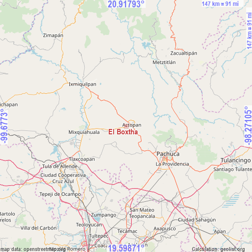
El Boxtha GPS coordinates[2]
20° 15' 34.992" North, 98° 58' 27.012" West
| Map corner | latitude | longitude |
|---|---|---|
| Upper-left | 20.91793°, | -99.6773° |
| Center: | 20.25972°, | -98.97417° |
| Lower-right: | 19.59871°, | -98.27105° |
| Map W x H: | 146.7×146.7 km | = 91.2×91.2mi |
| max Lat: | 32.7° ⇑37.3% North |
| El Boxtha: | 20.25972° |
| min Lat: | ⇓62.7% South 14.53588° |
| min Long | El Boxtha | max Long |
| -117.105° | -98.97417° | -86.73105° |
| W 50.6%⇐ | ⇒49.4% E |
Elevation
Elevation of El Boxtha is 1966 m = 6450 ft, and this is 712.3 m = 2337 ft above average elevation for this country.
| Max E: |
3497 m = 11473 ft | 28% |
| El Boxtha | 1966 m 6450 ft | |
| Avg. | 1253.7 m = 4113 ft | |
Min E: |
-1 m = -3 ft | 72% |
See also: Mexico elevation on elevation.city.
Geographical zone
El Boxtha is located in North Torrid zone (between Equator and Tropic of Cancer). Distance of this Northern Tropic circle is 353.2 km =219.5 mi to North.| Distance of | km | miles | from El Boxtha |
|---|---|---|---|
| North Pole | 7754.4 | 4818.4 | to North |
| Arctic Circle | 5148.5 | 3199.1 | to North |
| Tropic Cancer | 353.2 | 219.5 | to North |
| Equator | 2252.7 | 1399.8 | to South |


Nearby cities:
15 places around El Boxtha: (largest is in red/bold)
• Actopan
3.4 km =2.1 mi,  70°
70°
• Bocaja
3.8 km =2.4 mi,  287°
287°
• Bothi Bají
3.5 km =2.2 mi,  122°
122°
• Casa Blanca
2.5 km =1.6 mi,  222°
222°
• Caxuxi
5.3 km =3.3 mi,  341°
341°
• Colonia Veinte de Noviembre
5.2 km =3.2 mi, 115°
• Daxtha
2.3 km =1.4 mi,  345°
345°
• El Bondho
4.3 km =2.7 mi,  311°
311°
• El Huaxtho
3.1 km =1.9 mi,  156°
156°
• El Jiadi
5 km =3.1 mi,  104°
104°
• La Loma
4.3 km =2.7 mi,  93°
93°
• Poxindeje de Morelos
2.5 km =1.6 mi, 294°
• San Antonio Zaragoza
2.6 km =1.6 mi,  258°
258°
• San Salvador
5.1 km =3.2 mi,  304°
304°
• Santa María Amajac
4.2 km =2.6 mi, 216°
Sources, notices
• [Note1] Compared only with cities in Mexico existing in our database
• [Src1] Map data: © OpenStreetMap contributors (CC-BY-SA)
• [Src2] Other city data from geonames.org with taken over terms of usage.
• [Src3] Geographical zone / Annual Mean Temperature by Robert A. Rohde @ Wikipedia
