La Raya geodata
La Raya (State of Mexico) is a populated place; located in Mexico in America/Mexico_City (GMT-6) time zone. With population of 957 people, there are 9106 cities with bigger population in this country. Compared to other cities in Mexico, 55.8% of cities are located further ↑North; 57.9% of cities are located further →East and 94.7% of cities have lower elevation than La Raya. Note1


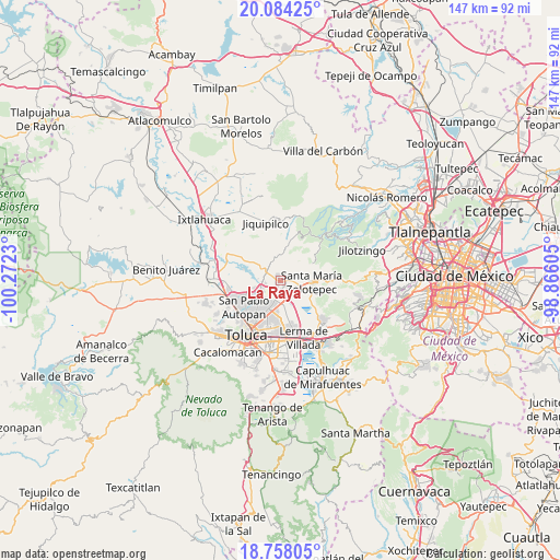
La Raya GPS coordinates[2]
19° 25' 21" North, 99° 34' 9.012" West
| Map corner | latitude | longitude |
|---|---|---|
| Upper-left | 20.08425°, | -100.2723° |
| Center: | 19.4225°, | -99.56917° |
| Lower-right: | 18.75805°, | -98.86605° |
| Map W x H: | 147.5×147.5 km | = 91.7×91.7mi |
| max Lat: | 32.7° ⇑55.8% North |
| La Raya: | 19.4225° |
| min Lat: | ⇓44.2% South 14.53588° |
| min Long | La Raya | max Long |
| -117.105° | -99.56917° | -86.73105° |
| W 42.1%⇐ | ⇒57.9% E |
Elevation
Elevation of La Raya is 2588 m = 8491 ft, and this is 1334.3 m = 4378 ft above average elevation for this country.
| Max E: |
3497 m = 11473 ft | 5.3% |
| La Raya | 2588 m 8491 ft | |
| Avg. | 1253.7 m = 4113 ft | |
Min E: |
-1 m = -3 ft | 94.7% |
See also: Mexico elevation on elevation.city.
Geographical zone
La Raya is located in North Torrid zone (between Equator and Tropic of Cancer). Distance of this Northern Tropic circle is 446.3 km =277.3 mi to North.| Distance of | km | miles | from La Raya |
|---|---|---|---|
| North Pole | 7847.5 | 4876.2 | to North |
| Arctic Circle | 5241.6 | 3257 | to North |
| Tropic Cancer | 446.3 | 277.3 | to North |
| Equator | 2159.6 | 1341.9 | to South |


Nearby cities:
15 places around La Raya: (largest is in red/bold)
• Barrio de San Juan
3.5 km =2.2 mi,  105°
105°
• Barrio de la Barranca
1.9 km =1.2 mi,  37°
37°
• Ejido de Mozoquilpan
4.3 km =2.7 mi,  87°
87°
• Fraccionamiento Rinconada del Valle
1.4 km =0.9 mi,  202°
202°
• La Joya
3.4 km =2.1 mi,  192°
192°
• La Loma de Puente San Pedro
1.8 km =1.1 mi,  240°
240°
• La Paja
0.7 km =0.4 mi, 198°
• La Y
3.5 km =2.2 mi,  218°
218°
• Loma de San Nicolás
4.3 km =2.7 mi,  297°
297°
• San Agustín Mimbres
3.4 km =2.1 mi,  23°
23°
• San Isidro las Trojes
3.3 km =2.1 mi,  69°
69°
• San José Buenavista el Grande
2 km =1.2 mi, 219°
• San Lorenzo Oyamel
1.5 km =0.9 mi,  324°
324°
• San Mateo Mozoquilpan
2 km =1.2 mi,  49°
49°
• Villa Cuauhtémoc
1.3 km =0.8 mi,  120°
120°
Sources, notices
• [Note1] Compared only with cities in Mexico existing in our database
• [Src1] Map data: © OpenStreetMap contributors (CC-BY-SA)
• [Src2] Other city data from geonames.org with taken over terms of usage.
• [Src3] Geographical zone / Annual Mean Temperature by Robert A. Rohde @ Wikipedia
