El Zapote geodata
El Zapote (San Luis Potosí) is a populated place; located in Mexico in America/Mexico_City (GMT-6) time zone. With population of 920 people, there are 9489 cities with bigger population in this country. Compared to other cities in Mexico, 85.2% of cities are located further ↓South; 72.9% of cities are located further →East and 65.9% of cities have lower elevation than El Zapote. Note1


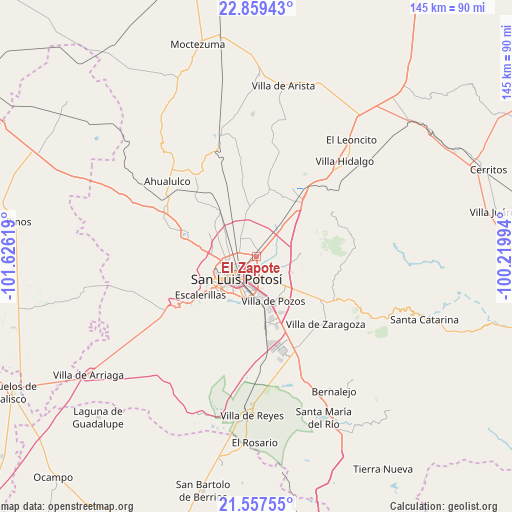
El Zapote GPS coordinates[2]
22° 12' 36" North, 100° 55' 23.016" West
| Map corner | latitude | longitude |
|---|---|---|
| Upper-left | 22.85943°, | -101.62619° |
| Center: | 22.21°, | -100.92306° |
| Lower-right: | 21.55755°, | -100.21994° |
| Map W x H: | 144.8×144.8 km | = 90×90mi |
| max Lat: | 32.7° ⇑14.8% North |
| El Zapote: | 22.21° |
| min Lat: | ⇓85.2% South 14.53588° |
| min Long | El Zapote | max Long |
| -117.105° | -100.92306° | -86.73105° |
| W 27.1%⇐ | ⇒72.9% E |
Elevation
Elevation of El Zapote is 1848 m = 6063 ft, and this is 594.3 m = 1950 ft above average elevation for this country.
| Max E: |
3497 m = 11473 ft | 34.1% |
| El Zapote | 1848 m 6063 ft | |
| Avg. | 1253.7 m = 4113 ft | |
Min E: |
-1 m = -3 ft | 65.9% |
See also: Mexico elevation on elevation.city.
Geographical zone
El Zapote is located in North Torrid zone (between Equator and Tropic of Cancer). Distance of this Northern Tropic circle is 136.4 km =84.8 mi to North.| Distance of | km | miles | from El Zapote |
|---|---|---|---|
| North Pole | 7537.5 | 4683.6 | to North |
| Arctic Circle | 4931.7 | 3064.4 | to North |
| Tropic Cancer | 136.4 | 84.8 | to North |
| Equator | 2469.5 | 1534.5 | to South |


Nearby cities:
15 places around El Zapote: (largest is in red/bold)
• Bosques la Florida
9.7 km =6 mi,  134°
134°
• Colorada
10.8 km =6.7 mi,  290°
290°
• Enrique Estrada
4.9 km =3 mi,  46°
46°
• Estanzuela
10.9 km =6.8 mi,  306°
306°
• Fracción Milpillas
4.7 km =2.9 mi,  295°
295°
• Fracción la Angostura Norte
8.3 km =5.2 mi,  269°
269°
• Los Gómez
7.5 km =4.7 mi,  145°
145°
• Los Moreno
9.8 km =6.1 mi, 299°
• Maravillas
9.6 km =6 mi, 289°
• Monte Obscuro
10.9 km =6.8 mi,  275°
275°
• Palma de la Cruz
5.8 km =3.6 mi,  69°
69°
• Rancho Nuevo
1.4 km =0.9 mi,  0°
0°
• Rinconada
5.5 km =3.4 mi,  330°
330°
• San Luis Potosí
8.8 km =5.5 mi,  220°
220°
• Soledad de Graciano Sánchez
2.8 km =1.7 mi,  213°
213°
Sources, notices
• [Note1] Compared only with cities in Mexico existing in our database
• [Src1] Map data: © OpenStreetMap contributors (CC-BY-SA)
• [Src2] Other city data from geonames.org with taken over terms of usage.
• [Src3] Geographical zone / Annual Mean Temperature by Robert A. Rohde @ Wikipedia
