Los Mangos geodata
Los Mangos (Veracruz) is a populated place; located in Mexico in America/Mexico_City (GMT-6) time zone. With population of 909 people, there are 9599 cities with bigger population in this country. Compared to other cities in Mexico, 68.4% of cities are located further ↑North; 77.7% of cities are located further ←West and 69.3% of cities have higher elevation than Los Mangos. Note1


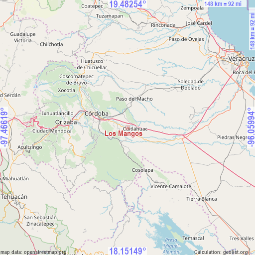
Los Mangos GPS coordinates[2]
18° 49' 5.988" North, 96° 45' 47.016" West
| Map corner | latitude | longitude |
|---|---|---|
| Upper-left | 19.48254°, | -97.46619° |
| Center: | 18.81833°, | -96.76306° |
| Lower-right: | 18.15149°, | -96.05994° |
| Map W x H: | 148×148 km | = 92×92mi |
| max Lat: | 32.7° ⇑68.4% North |
| Los Mangos: | 18.81833° |
| min Lat: | ⇓31.6% South 14.53588° |
| min Long | Los Mangos | max Long |
| -117.105° | -96.76306° | -86.73105° |
| W 77.7%⇐ | ⇒22.3% E |
Elevation
Elevation of Los Mangos is 453 m = 1486 ft, and this is 800.7 m = 2627 ft below average elevation for this country.
| Max E: |
3497 m = 11473 ft | 69.3% |
| Avg. | 1253.7 m = 4113 ft | |
| Los Mangos | 453 m = 1486 ft | |
Min E: |
-1 m = -3 ft | 30.7% |
See also: Mexico elevation on elevation.city.
Geographical zone
Los Mangos is located in North Torrid zone (between Equator and Tropic of Cancer). Distance of this Northern Tropic circle is 513.5 km =319.1 mi to North.| Distance of | km | miles | from Los Mangos |
|---|---|---|---|
| North Pole | 7914.7 | 4918 | to North |
| Arctic Circle | 5308.8 | 3298.7 | to North |
| Tropic Cancer | 513.5 | 319.1 | to North |
| Equator | 2092.4 | 1300.2 | to South |


Nearby cities:
15 places around Los Mangos: (largest is in red/bold)
• Adolfo López Mateos (San José de Enmedio)
3.1 km =1.9 mi,  256°
256°
• Corral de Piedra
4.1 km =2.5 mi,  1°
1°
• Cuitláhuac
4.3 km =2.7 mi,  96°
96°
• División del Norte (Santa Rosa)
4 km =2.5 mi,  69°
69°
• El Maguey
3.4 km =2.1 mi,  61°
61°
• El Tamarindo
2.8 km =1.7 mi,  109°
109°
• General Alatriste (San Joaquín)
4 km =2.5 mi,  307°
307°
• General Francisco Paz (El Poblado)
5.2 km =3.2 mi,  301°
301°
• General Juan José Baz (San José del Corral)
5.8 km =3.6 mi,  273°
273°
• La Loma de Guadalupe
6.1 km =3.8 mi, 265°
• Palmillas
1 km =0.6 mi,  249°
249°
• San Francisco (Mata Clara)
1.8 km =1.1 mi, 103°
• San Francisco de las Mesillas
1.9 km =1.2 mi, 312°
• San José de Abajo
5 km =3.1 mi,  197°
197°
• Yanga
4.1 km =2.5 mi,  293°
293°
Sources, notices
• [Note1] Compared only with cities in Mexico existing in our database
• [Src1] Map data: © OpenStreetMap contributors (CC-BY-SA)
• [Src2] Other city data from geonames.org with taken over terms of usage.
• [Src3] Geographical zone / Annual Mean Temperature by Robert A. Rohde @ Wikipedia
