La Loma de Guadalupe geodata
La Loma de Guadalupe (Veracruz) is a populated place; located in Mexico in America/Mexico_City (GMT-6) time zone. With population of 677 people, there are 12831 cities with bigger population in this country. Compared to other cities in Mexico, 68.5% of cities are located further ↑North; 77% of cities are located further ←West and 68.2% of cities have higher elevation than La Loma de Guadalupe. Note1
Current local time in La Loma de Guadalupe:
08:35 AM, WednesdayDifference from your time zone: hours


La Loma de Guadalupe GPS coordinates[2]
18° 48' 51.984" North, 96° 49' 15.996" West
| Map corner | latitude | longitude |
|---|---|---|
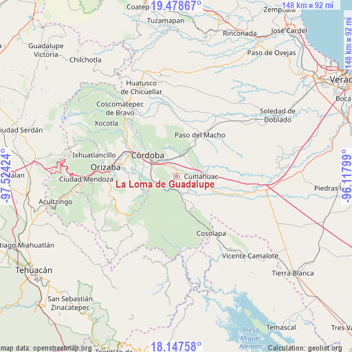
| Upper-left | 19.47867°, | -97.52424° |
| Center: | 18.81444°, | -96.82111° |
| Lower-right: | 18.14758°, | -96.11799° |
| Map W x H: | 148×148 km | = 92×92mi |
| max Lat: | 32.7° ⇑68.5% North |
| La Loma de Guadalupe: | 18.81444° |
| min Lat: | ⇓31.5% South 14.53588° |
| min Long | La Loma de Guad | max Long |
| -117.105° | -96.82111° | -86.73105° |
| W 77%⇐ | ⇒23% E |
Elevation
Elevation of La Loma de Guadalupe is 520 m = 1706 ft, and this is 733.7 m = 2407 ft below average elevation for this country.
| Max E: |
3497 m = 11473 ft | 68.2% |
| Avg. | 1253.7 m = 4113 ft | |
| La Loma de Guadalupe | 520 m = 1706 ft | |
Min E: |
-1 m = -3 ft | 31.8% |
See also: Mexico elevation on elevation.city.
Geographical zone
La Loma de Guadalupe is located in North Torrid zone (between Equator and Tropic of Cancer). Distance of this Northern Tropic circle is 513.9 km =319.3 mi to North.| Distance of | km | miles | from La Loma de Guadalupe |
|---|---|---|---|
| North Pole | 7915.1 | 4918.2 | to North |
| Arctic Circle | 5309.2 | 3299 | to North |
| Tropic Cancer | 513.9 | 319.3 | to North |
| Equator | 2092 | 1299.9 | to South |


Nearby cities:
15 places around La Loma de Guadalupe: (largest is in red/bold)
• Adolfo López Mateos (San José de Enmedio)
3.1 km =1.9 mi,  95°
95°
• Barrio Guadalupe
6.3 km =3.9 mi,  241°
241°
• Cacahuatal
2.9 km =1.8 mi,  310°
310°
• Ex-hacienda la Concepción
3.8 km =2.4 mi,  354°
354°
• General Alatriste (San Joaquín)
4.1 km =2.5 mi,  45°
45°
• General Francisco Paz (El Poblado)
3.6 km =2.2 mi,  27°
27°
• General Juan José Baz (San José del Corral)
0.9 km =0.6 mi,  21°
21°
• Los Mangos
6.1 km =3.8 mi,  85°
85°
• Palmillas
5.2 km =3.2 mi, 89°
• San Antonio Fraternidad
3.9 km =2.4 mi,  328°
328°
• San Francisco de las Mesillas
5 km =3.1 mi,  69°
69°
• San José de Abajo
6.3 km =3.9 mi,  132°
132°
• Venta Parada
5.1 km =3.2 mi,  323°
323°
• Xuchiles
6.1 km =3.8 mi,  180°
180°
• Yanga
3.2 km =2 mi, 49°
Sources, notices
• [Note1] Compared only with cities in Mexico existing in our database
• [Src1] Map data: © OpenStreetMap contributors (CC-BY-SA)
• [Src2] Other city data from geonames.org with taken over terms of usage.
• [Src3] Geographical zone / Annual Mean Temperature by Robert A. Rohde @ Wikipedia
