Sección la Toma geodata
Sección la Toma (Chiapas) is a populated place; located in Mexico in America/Mexico_City (GMT-6) time zone. With population of 800 people, there are 10908 cities with bigger population in this country. Compared to other cities in Mexico, 99.6% of cities are located further ↑North; 94.4% of cities are located further ←West and 70.4% of cities have higher elevation than Sección la Toma. Note1


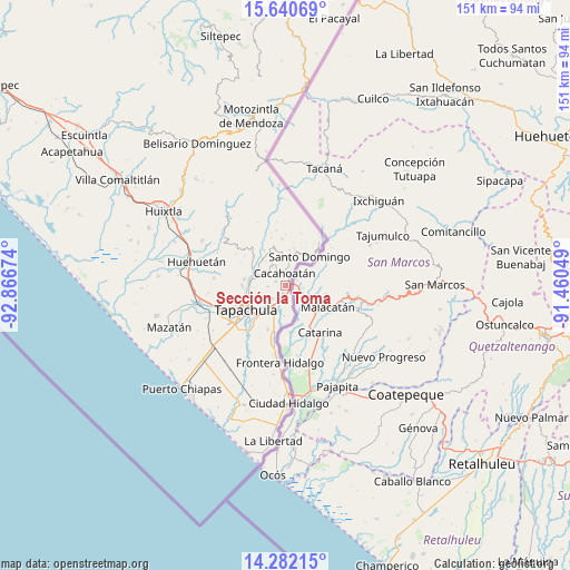
Sección la Toma GPS coordinates[2]
14° 57' 45" North, 92° 9' 48.996" West
| Map corner | latitude | longitude |
|---|---|---|
| Upper-left | 15.64069°, | -92.86674° |
| Center: | 14.9625°, | -92.16361° |
| Lower-right: | 14.28215°, | -91.46049° |
| Map W x H: | 151.1×151.1 km | = 93.9×93.9mi |
| max Lat: | 32.7° ⇑99.6% North |
| Sección la Toma: | 14.9625° |
| min Lat: | ⇓0.4% South 14.53588° |
| min Long | Sección la Tom | max Long |
| -117.105° | -92.16361° | -86.73105° |
| W 94.4%⇐ | ⇒5.6% E |
Elevation
Elevation of Sección la Toma is 399 m = 1309 ft, and this is 854.7 m = 2804 ft below average elevation for this country.
| Max E: |
3497 m = 11473 ft | 70.4% |
| Avg. | 1253.7 m = 4113 ft | |
| Sección la Toma | 399 m = 1309 ft | |
Min E: |
-1 m = -3 ft | 29.6% |
See also: Mexico elevation on elevation.city.
Geographical zone
Sección la Toma is located in North Torrid zone (between Equator and Tropic of Cancer). Distance of this Northern Tropic circle is 942.2 km =585.5 mi to North.| Distance of | km | miles | from Sección la Toma |
|---|---|---|---|
| North Pole | 8343.4 | 5184.3 | to North |
| Arctic Circle | 5737.5 | 3565.1 | to North |
| Tropic Cancer | 942.2 | 585.5 | to North |
| Equator | 1663.7 | 1033.8 | to South |


Nearby cities:
15 places around Sección la Toma: (largest is in red/bold)
• 1ra. Sección de Izapa
4.7 km =2.9 mi,  189°
189°
• Cacahoatán
3.3 km =2.1 mi,  359°
359°
• Carrillo Puerto
6.4 km =4 mi,  327°
327°
• Dos de Mayo
6.8 km =4.2 mi,  12°
12°
• El Carmen
7.6 km =4.7 mi,  0°
0°
• El Triunfo
7 km =4.3 mi,  296°
296°
• Hermosillo
5 km =3.1 mi,  314°
314°
• Manuel Lazos
2.7 km =1.7 mi,  291°
291°
• Miguel Hidalgo
5.7 km =3.5 mi,  240°
240°
• Mixcum
7.4 km =4.6 mi,  19°
19°
• Rosario Ixtal
5.1 km =3.2 mi, 10°
• San Agustín Jitotol
6.8 km =4.2 mi, 304°
• Silvano Gatica
4.5 km =2.8 mi,  265°
265°
• Talismán
1.8 km =1.1 mi,  86°
86°
• Tuxtla Chico
2.6 km =1.6 mi, 188°
Sources, notices
• [Note1] Compared only with cities in Mexico existing in our database
• [Src1] Map data: © OpenStreetMap contributors (CC-BY-SA)
• [Src2] Other city data from geonames.org with taken over terms of usage.
• [Src3] Geographical zone / Annual Mean Temperature by Robert A. Rohde @ Wikipedia
