Los Llanitos (El Ranchito) geodata
Los Llanitos (El Ranchito) (Guanajuato) is a populated place; located in Mexico in America/Mexico_City (GMT-6) time zone. With population of 792 people, there are 11019 cities with bigger population in this country. Compared to other cities in Mexico, 65.2% of cities are located further ↓South; 74.2% of cities are located further →East and 60.1% of cities have lower elevation than Los Llanitos (El Ranchito). Note1
Current local time in Los Llanitos (El Ranchito):
11:19 AM, MondayDifference from your time zone: hours


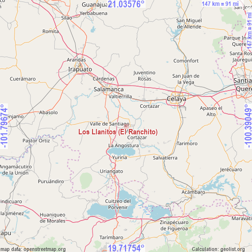
Los Llanitos (El Ranchito) GPS coordinates[2]
20° 22' 41.016" North, 101° 5' 36.996" West
| Map corner | latitude | longitude |
|---|---|---|
| Upper-left | 21.03576°, | -101.79674° |
| Center: | 20.37806°, | -101.09361° |
| Lower-right: | 19.71754°, | -100.39049° |
| Map W x H: | 146.6×146.6 km | = 91.1×91.1mi |
| max Lat: | 32.7° ⇑34.8% North |
| Los Llanitos (El Ranchito): | 20.37806° |
| min Lat: | ⇓65.2% South 14.53588° |
| min Long | Los Llanitos (E | max Long |
| -117.105° | -101.09361° | -86.73105° |
| W 25.8%⇐ | ⇒74.2% E |
Elevation
Elevation of Los Llanitos (El Ranchito) is 1727 m = 5666 ft, and this is 473.3 m = 1553 ft above average elevation for this country.
| Max E: |
3497 m = 11473 ft | 39.9% |
| Los Llanitos (El Ranchito) | 1727 m 5666 ft | |
| Avg. | 1253.7 m = 4113 ft | |
Min E: |
-1 m = -3 ft | 60.1% |
See also: Mexico elevation on elevation.city.
Geographical zone
Los Llanitos (El Ranchito) is located in North Torrid zone (between Equator and Tropic of Cancer). Distance of this Northern Tropic circle is 340.1 km =211.3 mi to North.| Distance of | km | miles | from Los Llanitos (El Ranchito) |
|---|---|---|---|
| North Pole | 7741.2 | 4810.2 | to North |
| Arctic Circle | 5135.3 | 3190.9 | to North |
| Tropic Cancer | 340.1 | 211.3 | to North |
| Equator | 2265.8 | 1407.9 | to South |


Nearby cities:
15 places around Los Llanitos (El Ranchito): (largest is in red/bold)
• Bella Vista de Santa María
3.3 km =2.1 mi,  238°
238°
• El Molinito
6 km =3.7 mi,  22°
22°
• El Perico
5.1 km =3.2 mi, 240°
• Hacienda de la Bolsa
1.2 km =0.7 mi,  254°
254°
• Jaral del Progreso
3.3 km =2.1 mi,  101°
101°
• La Compañía
6.8 km =4.2 mi,  269°
269°
• La Enmarañada
4.4 km =2.7 mi,  336°
336°
• La Isla
8.1 km =5 mi,  349°
349°
• Pozo de Aróstegui (Las Correas)
5.7 km =3.5 mi, 243°
• Sabino de Santa Rosa
5.2 km =3.2 mi,  329°
329°
• San José de Araceo
7.4 km =4.6 mi, 270°
• San José del Cerrito de Camargo
7 km =4.3 mi,  49°
49°
• Santa Ana
2 km =1.2 mi, 254°
• Victoria de Cortazar
8.1 km =5 mi,  126°
126°
• Zempoala
6.9 km =4.3 mi,  166°
166°
Sources, notices
• [Note1] Compared only with cities in Mexico existing in our database
• [Src1] Map data: © OpenStreetMap contributors (CC-BY-SA)
• [Src2] Other city data from geonames.org with taken over terms of usage.
• [Src3] Geographical zone / Annual Mean Temperature by Robert A. Rohde @ Wikipedia
