Allende geodata
Allende (Sonora) is a populated place; located in Mexico in America/Hermosillo (GMT-7) time zone. With population of 1,810 people, there are 4809 cities with bigger population in this country. Compared to other cities in Mexico, 96.6% of cities are located further ↓South; 98% of cities are located further →East and 90.8% of cities have higher elevation than Allende. Note1


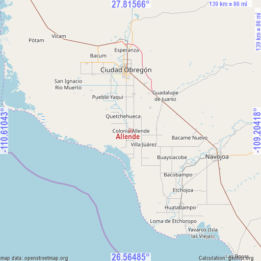
Allende GPS coordinates[2]
27° 11' 31.236" North, 109° 54' 26.28" West
| Map corner | latitude | longitude |
|---|---|---|
| Upper-left | 27.81566°, | -110.61043° |
| Center: | 27.19201°, | -109.9073° |
| Lower-right: | 26.56485°, | -109.20418° |
| Map W x H: | 139.1×139.1 km | = 86.4×86.4mi |
| max Lat: | 32.7° ⇑3.4% North |
| Allende: | 27.19201° |
| min Lat: | ⇓96.6% South 14.53588° |
| min Long | Allende | max Long |
| -117.105° | -109.9073° | -86.73105° |
| W 2%⇐ | ⇒98% E |
Elevation
Elevation of Allende is 22 m = 72 ft, and this is 1231.7 m = 4041 ft below average elevation for this country.
| Max E: |
3497 m = 11473 ft | 90.8% |
| Avg. | 1253.7 m = 4113 ft | |
| Allende | 22 m = 72 ft | |
Min E: |
-1 m = -3 ft | 9.2% |
See also: Mexico elevation on elevation.city.
Geographical zone
Allende is located in North temperate zone (between Tropic of Cancer and the Arctic Circle). Distance of this Northern Tropic circle is 417.5 km =259.4 mi to South.| Distance of | km | miles | from Allende |
|---|---|---|---|
| North Pole | 6983.6 | 4339.4 | to North |
| Arctic Circle | 4377.7 | 2720.2 | to North |
| Tropic Cancer | 417.5 | 259.4 | to South |
| Equator | 3023.5 | 1878.7 | to South |


Nearby cities:
15 places around Allende: (largest is in red/bold)
• 31 de Octubre
17.3 km =10.7 mi,  311°
311°
• Agua Blanca
19.2 km =11.9 mi,  116°
116°
• Altos de Jecopaco
2.7 km =1.7 mi,  150°
150°
• Antonio Rosales
18.5 km =11.5 mi,  16°
16°
• El Paredoncito
14.8 km =9.2 mi,  182°
182°
• El Tobarito
19.9 km =12.4 mi,  3°
3°
• Etchohuaquila
20.5 km =12.7 mi,  46°
46°
• Francisco Villa
22 km =13.7 mi,  26°
26°
• Jecopaco
13.7 km =8.5 mi,  87°
87°
• Marte R. Gómez (Tobarito)
19.7 km =12.2 mi,  6°
6°
• Morelos Uno
13 km =8.1 mi,  317°
317°
• Paredón Colorado
12.8 km =8 mi,  191°
191°
• Quetchehueca
9 km =5.6 mi,  332°
332°
• Santa María del Buáraje
16 km =9.9 mi,  40°
40°
• Villa Juárez
9.8 km =6.1 mi,  136°
136°
Sources, notices
• [Note1] Compared only with cities in Mexico existing in our database
• [Src1] Map data: © OpenStreetMap contributors (CC-BY-SA)
• [Src2] Other city data from geonames.org with taken over terms of usage.
• [Src3] Geographical zone / Annual Mean Temperature by Robert A. Rohde @ Wikipedia
