La Mesa geodata
La Mesa (Michoacán) is a populated place; located in Mexico in America/Mexico_City (GMT-6) time zone. With population of 787 people, there are 11101 cities with bigger population in this country. Compared to other cities in Mexico, 52.1% of cities are located further ↓South; 65.8% of cities are located further →East and 99.7% of cities have lower elevation than La Mesa. Note1


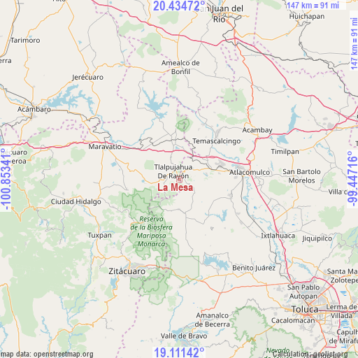
La Mesa GPS coordinates[2]
19° 46' 27.984" North, 100° 9' 1.008" West
| Map corner | latitude | longitude |
|---|---|---|
| Upper-left | 20.43472°, | -100.85341° |
| Center: | 19.77444°, | -100.15028° |
| Lower-right: | 19.11142°, | -99.44716° |
| Map W x H: | 147.1×147.1 km | = 91.4×91.4mi |
| max Lat: | 32.7° ⇑47.9% North |
| La Mesa: | 19.77444° |
| min Lat: | ⇓52.1% South 14.53588° |
| min Long | La Mesa | max Long |
| -117.105° | -100.15028° | -86.73105° |
| W 34.2%⇐ | ⇒65.8% E |
Elevation
Elevation of La Mesa is 2940 m = 9646 ft, and this is 1686.3 m = 5532 ft above average elevation for this country.
| Max E: |
3497 m = 11473 ft | 0.3% |
| La Mesa | 2940 m 9646 ft | |
| Avg. | 1253.7 m = 4113 ft | |
Min E: |
-1 m = -3 ft | 99.7% |
See also: Mexico elevation on elevation.city.
Geographical zone
La Mesa is located in North Torrid zone (between Equator and Tropic of Cancer). Distance of this Northern Tropic circle is 407.2 km =253 mi to North.| Distance of | km | miles | from La Mesa |
|---|---|---|---|
| North Pole | 7808.4 | 4851.9 | to North |
| Arctic Circle | 5202.5 | 3232.7 | to North |
| Tropic Cancer | 407.2 | 253 | to North |
| Equator | 2198.7 | 1366.2 | to South |


Nearby cities:
15 places around La Mesa: (largest is in red/bold)
• Barrio del Gigante
5.8 km =3.6 mi,  98°
98°
• Barrio la Estrellita
4.9 km =3 mi,  28°
28°
• Cerro Llorón
3.3 km =2.1 mi,  109°
109°
• Colonia Cuauhtémoc
2 km =1.2 mi,  83°
83°
• El Oro de Hidalgo
3.7 km =2.3 mi, 32°
• Estanzuela (La Hacienda)
3.3 km =2.1 mi,  268°
268°
• Los Remedios
5.5 km =3.4 mi,  301°
301°
• Presa Brockman
1.2 km =0.7 mi,  128°
128°
• San Isidro
5.6 km =3.5 mi,  262°
262°
• San Juan Tlalpujahuilla (Tlalpujahuilla)
2.3 km =1.4 mi,  320°
320°
• San Nicolás el Oro
4.9 km =3 mi,  44°
44°
• Santa María de los Ángeles
5.3 km =3.3 mi,  284°
284°
• Santa Rosa de Lima
5.8 km =3.6 mi, 77°
• Santiago Oxtempan
3 km =1.9 mi, 77°
• Tlalpujahua de Rayón
4.2 km =2.6 mi, 323°
Sources, notices
• [Note1] Compared only with cities in Mexico existing in our database
• [Src1] Map data: © OpenStreetMap contributors (CC-BY-SA)
• [Src2] Other city data from geonames.org with taken over terms of usage.
• [Src3] Geographical zone / Annual Mean Temperature by Robert A. Rohde @ Wikipedia
