Tlalpujahua de Rayón geodata
Tlalpujahua de Rayón (Michoacán) is a seat of a second-order administrative division; located in Mexico in America/Mexico_City (GMT-6) time zone. With population of 3,530 people, there are 2584 cities with bigger population in this country. Compared to other cities in Mexico, 52.9% of cities are located further ↓South; 66.2% of cities are located further →East and 94.4% of cities have lower elevation than Tlalpujahua de Rayón. Note1


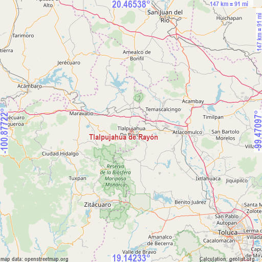
Tlalpujahua de Rayón GPS coordinates[2]
19° 48' 18.828" North, 100° 10' 26.724" West
| Map corner | latitude | longitude |
|---|---|---|
| Upper-left | 20.46538°, | -100.87722° |
| Center: | 19.80523°, | -100.17409° |
| Lower-right: | 19.14233°, | -99.47097° |
| Map W x H: | 147.1×147.1 km | = 91.4×91.4mi |
| max Lat: | 32.7° ⇑47.1% North |
| Tlalpujahua de Rayón: | 19.80523° |
| min Lat: | ⇓52.9% South 14.53588° |
| min Long | Tlalpujahua de | max Long |
| -117.105° | -100.17409° | -86.73105° |
| W 33.8%⇐ | ⇒66.2% E |
Elevation
Elevation of Tlalpujahua de Rayón is 2583 m = 8474 ft, and this is 1329.3 m = 4361 ft above average elevation for this country.
| Max E: |
3497 m = 11473 ft | 5.6% |
| Tlalpujahua de Rayón | 2583 m 8474 ft | |
| Avg. | 1253.7 m = 4113 ft | |
Min E: |
-1 m = -3 ft | 94.4% |
See also: Mexico elevation on elevation.city.
Geographical zone
Tlalpujahua de Rayón is located in North Torrid zone (between Equator and Tropic of Cancer). Distance of this Northern Tropic circle is 403.8 km =250.9 mi to North.| Distance of | km | miles | from Tlalpujahua de Rayón |
|---|---|---|---|
| North Pole | 7804.9 | 4849.7 | to North |
| Arctic Circle | 5199 | 3230.5 | to North |
| Tropic Cancer | 403.8 | 250.9 | to North |
| Equator | 2202.1 | 1368.3 | to South |


Nearby cities:
15 places around Tlalpujahua de Rayón: (largest is in red/bold)
• Barrio la Estrellita
4.9 km =3 mi,  79°
79°
• Colonia Cuauhtémoc
5.5 km =3.4 mi,  125°
125°
• El Gigante
5.4 km =3.4 mi,  336°
336°
• El Oro de Hidalgo
4.5 km =2.8 mi,  93°
93°
• Estanzuela (La Hacienda)
3.6 km =2.2 mi,  193°
193°
• La Mesa
4.2 km =2.6 mi,  143°
143°
• Los Remedios
2.3 km =1.4 mi,  257°
257°
• Monte Alegre
3.8 km =2.4 mi, 264°
• Presa Brockman
5.4 km =3.4 mi, 140°
• San Isidro
5.2 km =3.2 mi,  216°
216°
• San Juan Tlalpujahuilla (Tlalpujahuilla)
2 km =1.2 mi,  148°
148°
• San Nicolás el Oro
5.9 km =3.7 mi, 89°
• San Pedro Tarímbaro
5.4 km =3.4 mi,  273°
273°
• Sandía
3.6 km =2.2 mi,  288°
288°
• Santa María de los Ángeles
3.4 km =2.1 mi,  231°
231°
Sources, notices
• [Note1] Compared only with cities in Mexico existing in our database
• [Src1] Map data: © OpenStreetMap contributors (CC-BY-SA)
• [Src2] Other city data from geonames.org with taken over terms of usage.
• [Src3] Geographical zone / Annual Mean Temperature by Robert A. Rohde @ Wikipedia
