Cerro Llorón geodata
Cerro Llorón (State of Mexico) is a populated place; located in Mexico in America/Mexico_City (GMT-6) time zone. With population of 729 people, there are 11976 cities with bigger population in this country. Compared to other cities in Mexico, 51.8% of cities are located further ↓South; 65.5% of cities are located further →East and 99.8% of cities have lower elevation than Cerro Llorón. Note1


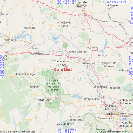
Cerro Llorón GPS coordinates[2]
19° 45' 53.388" North, 100° 7' 14.844" West
| Map corner | latitude | longitude |
|---|---|---|
| Upper-left | 20.42515°, | -100.82392° |
| Center: | 19.76483°, | -100.12079° |
| Lower-right: | 19.10177°, | -99.41767° |
| Map W x H: | 147.1×147.1 km | = 91.4×91.4mi |
| max Lat: | 32.7° ⇑48.2% North |
| Cerro Llorón: | 19.76483° |
| min Lat: | ⇓51.8% South 14.53588° |
| min Long | Cerro Llorón | max Long |
| -117.105° | -100.12079° | -86.73105° |
| W 34.5%⇐ | ⇒65.5% E |
Elevation
Elevation of Cerro Llorón is 2997 m = 9833 ft, and this is 1743.3 m = 5719 ft above average elevation for this country.
| Max E: |
3497 m = 11473 ft | 0.2% |
| Cerro Llorón | 2997 m 9833 ft | |
| Avg. | 1253.7 m = 4113 ft | |
Min E: |
-1 m = -3 ft | 99.8% |
See also: Mexico elevation on elevation.city.
Geographical zone
Cerro Llorón is located in North Torrid zone (between Equator and Tropic of Cancer). Distance of this Northern Tropic circle is 408.3 km =253.7 mi to North.| Distance of | km | miles | from Cerro Llorón |
|---|---|---|---|
| North Pole | 7809.4 | 4852.5 | to North |
| Arctic Circle | 5203.5 | 3233.3 | to North |
| Tropic Cancer | 408.3 | 253.7 | to North |
| Equator | 2197.6 | 1365.5 | to South |


Nearby cities:
15 places around Cerro Llorón: (largest is in red/bold)
• Barrio del Gigante
2.7 km =1.7 mi,  84°
84°
• Barrio la Estrellita
5.4 km =3.4 mi,  352°
352°
• Colonia Cuauhtémoc
1.7 km =1.1 mi,  319°
319°
• El Oro de Hidalgo
4.3 km =2.7 mi, 346°
• Guarda de Guadalupe
5.5 km =3.4 mi,  119°
119°
• La Mesa
3.3 km =2.1 mi,  289°
289°
• Pata de Mula de los Cedros (Patemula)
3.6 km =2.2 mi,  153°
153°
• Presa Brockman
2.2 km =1.4 mi,  278°
278°
• San Francisco Solo
5.9 km =3.7 mi, 149°
• San Juan Tlalpujahuilla (Tlalpujahuilla)
5.3 km =3.3 mi,  301°
301°
• San Miguel del Centro
5.1 km =3.2 mi,  165°
165°
• San Nicolás el Oro
4.6 km =2.9 mi,  4°
4°
• Santa Rita de la Cuesta
5.5 km =3.4 mi,  109°
109°
• Santa Rosa de Lima
3.5 km =2.2 mi,  47°
47°
• Santiago Oxtempan
1.7 km =1.1 mi,  356°
356°
Sources, notices
• [Note1] Compared only with cities in Mexico existing in our database
• [Src1] Map data: © OpenStreetMap contributors (CC-BY-SA)
• [Src2] Other city data from geonames.org with taken over terms of usage.
• [Src3] Geographical zone / Annual Mean Temperature by Robert A. Rohde @ Wikipedia
