Puerta de Alambre (Ayacuato) geodata
Puerta de Alambre (Ayacuato) (Michoacán) is a populated place; located in Mexico in America/Mexico_City (GMT-6) time zone. With population of 728 people, there are 11990 cities with bigger population in this country. Compared to other cities in Mexico, 64.3% of cities are located further ↑North; 83.8% of cities are located further →East and 74.5% of cities have higher elevation than Puerta de Alambre (Ayacuato). Note1
Current local time in Puerta de Alambre (Ayacuato):
12:54 AM, WednesdayDifference from your time zone: hours


Puerta de Alambre (Ayacuato) GPS coordinates[2]
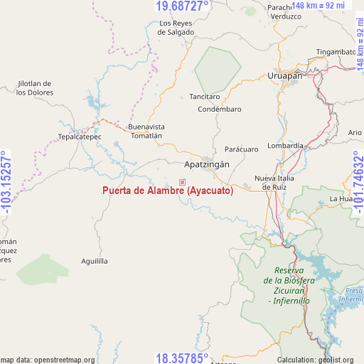
19° 1' 26.004" North, 102° 26' 57.984" West
| Map corner | latitude | longitude |
|---|---|---|
| Upper-left | 19.68727°, | -103.15257° |
| Center: | 19.02389°, | -102.44944° |
| Lower-right: | 18.35785°, | -101.74632° |
| Map W x H: | 147.8×147.8 km | = 91.8×91.8mi |
| max Lat: | 32.7° ⇑64.3% North |
| Puerta de Alambre (Ayacuato): | 19.02389° |
| min Lat: | ⇓35.7% South 14.53588° |
| min Long | Puerta de Alamb | max Long |
| -117.105° | -102.44944° | -86.73105° |
| W 16.2%⇐ | ⇒83.8% E |
Elevation
Elevation of Puerta de Alambre (Ayacuato) is 236 m = 774 ft, and this is 1017.7 m = 3339 ft below average elevation for this country.
| Max E: |
3497 m = 11473 ft | 74.5% |
| Avg. | 1253.7 m = 4113 ft | |
| Puerta de Alambre (Ayacuato) | 236 m = 774 ft | |
Min E: |
-1 m = -3 ft | 25.5% |
See also: Mexico elevation on elevation.city.
Geographical zone
Puerta de Alambre (Ayacuato) is located in North Torrid zone (between Equator and Tropic of Cancer). Distance of this Northern Tropic circle is 490.7 km =304.9 mi to North.| Distance of | km | miles | from Puerta de Alambre (Ayacuato) |
|---|---|---|---|
| North Pole | 7891.8 | 4903.7 | to North |
| Arctic Circle | 5285.9 | 3284.5 | to North |
| Tropic Cancer | 490.7 | 304.9 | to North |
| Equator | 2115.3 | 1314.4 | to South |


Nearby cities:
15 places around Puerta de Alambre (Ayacuato): (largest is in red/bold)
• Apatzingán
12.1 km =7.5 mi,  53°
53°
• Cenobio Moreno
9.9 km =6.2 mi,  324°
324°
• Chiquihuitillo
11.1 km =6.9 mi,  98°
98°
• El Recreo
10.1 km =6.3 mi,  18°
18°
• Fraccionamiento Girasoles
14.3 km =8.9 mi,  77°
77°
• Loma de los Hoyos
1.5 km =0.9 mi,  28°
28°
• Los Hornos
8.2 km =5.1 mi, 18°
• Pinzándaro
13.5 km =8.4 mi,  314°
314°
• Presa del Rosario
6.5 km =4 mi,  40°
40°
• Razo del Órgano (Veintiuno de Mayo)
7.1 km =4.4 mi,  285°
285°
• San Antonio la Labor
15.6 km =9.7 mi,  87°
87°
• San Juan De Los Platanos
12.6 km =7.8 mi,  4°
4°
• San Juan de los Plátanos
12.5 km =7.8 mi,  5°
5°
• Santa Ana Amatlán
18 km =11.2 mi,  327°
327°
• Vicente Guerrero
11.3 km =7 mi,  299°
299°
Sources, notices
• [Note1] Compared only with cities in Mexico existing in our database
• [Src1] Map data: © OpenStreetMap contributors (CC-BY-SA)
• [Src2] Other city data from geonames.org with taken over terms of usage.
• [Src3] Geographical zone / Annual Mean Temperature by Robert A. Rohde @ Wikipedia
