Santa Ana Amatlán geodata
Santa Ana Amatlán (Michoacán) is a populated place; located in Mexico in America/Mexico_City (GMT-6) time zone. With population of 4,189 people, there are 2188 cities with bigger population in this country. Compared to other cities in Mexico, 62% of cities are located further ↑North; 84.3% of cities are located further →East and 72.2% of cities have higher elevation than Santa Ana Amatlán. Note1


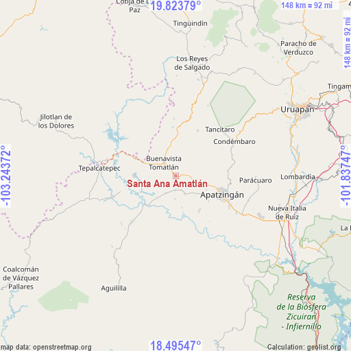
Santa Ana Amatlán GPS coordinates[2]
19° 9' 39.492" North, 102° 32' 26.124" West
| Map corner | latitude | longitude |
|---|---|---|
| Upper-left | 19.82379°, | -103.24372° |
| Center: | 19.16097°, | -102.54059° |
| Lower-right: | 18.49547°, | -101.83747° |
| Map W x H: | 147.7×147.7 km | = 91.8×91.8mi |
| max Lat: | 32.7° ⇑62% North |
| Santa Ana Amatlán: | 19.16097° |
| min Lat: | ⇓38% South 14.53588° |
| min Long | Santa Ana Amatl | max Long |
| -117.105° | -102.54059° | -86.73105° |
| W 15.7%⇐ | ⇒84.3% E |
Elevation
Elevation of Santa Ana Amatlán is 321 m = 1053 ft, and this is 932.7 m = 3060 ft below average elevation for this country.
| Max E: |
3497 m = 11473 ft | 72.2% |
| Avg. | 1253.7 m = 4113 ft | |
| Santa Ana Amatlán | 321 m = 1053 ft | |
Min E: |
-1 m = -3 ft | 27.8% |
See also: Mexico elevation on elevation.city.
Geographical zone
Santa Ana Amatlán is located in North Torrid zone (between Equator and Tropic of Cancer). Distance of this Northern Tropic circle is 475.4 km =295.4 mi to North.| Distance of | km | miles | from Santa Ana Amatlán |
|---|---|---|---|
| North Pole | 7876.6 | 4894.3 | to North |
| Arctic Circle | 5270.7 | 3275.1 | to North |
| Tropic Cancer | 475.4 | 295.4 | to North |
| Equator | 2130.5 | 1323.8 | to South |


Nearby cities:
15 places around Santa Ana Amatlán: (largest is in red/bold)
• Buenavista Tomatlán
7.6 km =4.7 mi,  319°
319°
• Buenavistilla (La Garita)
12.3 km =7.6 mi,  228°
228°
• Cenobio Moreno
8.1 km =5 mi,  151°
151°
• División del Norte
11.6 km =7.2 mi,  220°
220°
• El Recreo
14.1 km =8.8 mi,  113°
113°
• El Terrero
16.6 km =10.3 mi, 223°
• Loma de los Hoyos
17.3 km =10.7 mi,  143°
143°
• Los Hornos
14.3 km =8.9 mi,  121°
121°
• Pinzándaro
5.7 km =3.5 mi,  180°
180°
• Presa del Rosario
17.3 km =10.7 mi,  126°
126°
• Punta del Agua
15.2 km =9.4 mi,  241°
241°
• Razo del Órgano (Veintiuno de Mayo)
13.6 km =8.5 mi,  168°
168°
• San Juan De Los Platanos
11 km =6.8 mi,  104°
104°
• San Juan de los Plátanos
11.1 km =6.9 mi, 104°
• Vicente Guerrero
9.6 km =6 mi, 181°
Sources, notices
• [Note1] Compared only with cities in Mexico existing in our database
• [Src1] Map data: © OpenStreetMap contributors (CC-BY-SA)
• [Src2] Other city data from geonames.org with taken over terms of usage.
• [Src3] Geographical zone / Annual Mean Temperature by Robert A. Rohde @ Wikipedia
