Cenobio Moreno geodata
Cenobio Moreno (Michoacán) is a populated place; located in Mexico in America/Mexico_City (GMT-6) time zone. With population of 2,609 people, there are 3398 cities with bigger population in this country. Compared to other cities in Mexico, 63.2% of cities are located further ↑North; 84.1% of cities are located further →East and 74.2% of cities have higher elevation than Cenobio Moreno. Note1


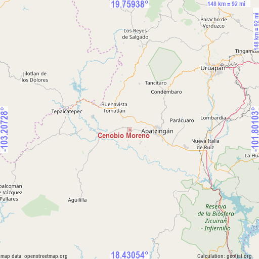
Cenobio Moreno GPS coordinates[2]
19° 5' 46.644" North, 102° 30' 14.94" West
| Map corner | latitude | longitude |
|---|---|---|
| Upper-left | 19.75938°, | -103.20728° |
| Center: | 19.09629°, | -102.50415° |
| Lower-right: | 18.43054°, | -101.80103° |
| Map W x H: | 147.8×147.8 km | = 91.8×91.8mi |
| max Lat: | 32.7° ⇑63.2% North |
| Cenobio Moreno: | 19.09629° |
| min Lat: | ⇓36.8% South 14.53588° |
| min Long | Cenobio Moreno | max Long |
| -117.105° | -102.50415° | -86.73105° |
| W 15.9%⇐ | ⇒84.1% E |
Elevation
Elevation of Cenobio Moreno is 248 m = 814 ft, and this is 1005.7 m = 3300 ft below average elevation for this country.
| Max E: |
3497 m = 11473 ft | 74.2% |
| Avg. | 1253.7 m = 4113 ft | |
| Cenobio Moreno | 248 m = 814 ft | |
Min E: |
-1 m = -3 ft | 25.8% |
See also: Mexico elevation on elevation.city.
Geographical zone
Cenobio Moreno is located in North Torrid zone (between Equator and Tropic of Cancer). Distance of this Northern Tropic circle is 482.6 km =299.9 mi to North.| Distance of | km | miles | from Cenobio Moreno |
|---|---|---|---|
| North Pole | 7883.8 | 4898.8 | to North |
| Arctic Circle | 5277.9 | 3279.5 | to North |
| Tropic Cancer | 482.6 | 299.9 | to North |
| Equator | 2123.3 | 1319.4 | to South |


Nearby cities:
15 places around Cenobio Moreno: (largest is in red/bold)
• Apatzingán
15.5 km =9.6 mi,  93°
93°
• Buenavista Tomatlán
15.6 km =9.7 mi,  325°
325°
• Buenavistilla (La Garita)
13.1 km =8.1 mi,  265°
265°
• División del Norte
11.5 km =7.1 mi,  261°
261°
• El Recreo
9.2 km =5.7 mi,  80°
80°
• Loma de los Hoyos
9.3 km =5.8 mi,  136°
136°
• Los Hornos
8.4 km =5.2 mi, 91°
• Pinzándaro
4.1 km =2.5 mi,  290°
290°
• Presa del Rosario
10.5 km =6.5 mi,  107°
107°
• Puerta de Alambre (Ayacuato)
9.9 km =6.2 mi, 144°
• Razo del Órgano (Veintiuno de Mayo)
6.3 km =3.9 mi,  189°
189°
• San Juan De Los Platanos
8.2 km =5.1 mi,  56°
56°
• San Juan de los Plátanos
8.2 km =5.1 mi, 57°
• Santa Ana Amatlán
8.1 km =5 mi, 331°
• Vicente Guerrero
4.7 km =2.9 mi,  239°
239°
Sources, notices
• [Note1] Compared only with cities in Mexico existing in our database
• [Src1] Map data: © OpenStreetMap contributors (CC-BY-SA)
• [Src2] Other city data from geonames.org with taken over terms of usage.
• [Src3] Geographical zone / Annual Mean Temperature by Robert A. Rohde @ Wikipedia
