Licenciado Luis Echeverría Álvarez (Playa Santa) geodata
Licenciado Luis Echeverría Álvarez (Playa Santa) (Veracruz) is a populated place; located in Mexico in America/Mexico_City (GMT-6) time zone. With population of 728 people, there are 11990 cities with bigger population in this country. Compared to other cities in Mexico, 85.1% of cities are located further ↑North; 86.3% of cities are located further ←West and 73.6% of cities have higher elevation than Licenciado Luis Echeverría Álvarez (Playa Santa). Note1
Current local time in Licenciado Luis Echeverría Álvarez (Playa Santa):
08:32 AM, WednesdayDifference from your time zone: hours


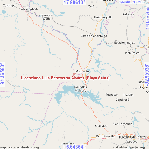
Licenciado Luis Echeverría Álvarez (Playa Santa) GPS coordinates[2]
17° 18' 57.996" North, 93° 39' 45" West
| Map corner | latitude | longitude |
|---|---|---|
| Upper-left | 17.98613°, | -94.36563° |
| Center: | 17.31611°, | -93.6625° |
| Lower-right: | 16.64364°, | -92.95938° |
| Map W x H: | 149.3×149.3 km | = 92.8×92.8mi |
| max Lat: | 32.7° ⇑85.1% North |
| Licenciado Luis Echeverría Álvarez (Playa Santa): | 17.31611° |
| min Lat: | ⇓14.9% South 14.53588° |
| min Long | Licenciado Luis | max Long |
| -117.105° | -93.6625° | -86.73105° |
| W 86.3%⇐ | ⇒13.7% E |
Elevation
Elevation of Licenciado Luis Echeverría Álvarez (Playa Santa) is 271 m = 889 ft, and this is 982.7 m = 3224 ft below average elevation for this country.
| Max E: |
3497 m = 11473 ft | 73.6% |
| Avg. | 1253.7 m = 4113 ft | |
| Licenciado Luis Echeverría Álvarez (Playa Santa) | 271 m = 889 ft | |
Min E: |
-1 m = -3 ft | 26.4% |
See also: Mexico elevation on elevation.city.
Geographical zone
Licenciado Luis Echeverría Álvarez (Playa Santa) is located in North Torrid zone (between Equator and Tropic of Cancer). Distance of this Northern Tropic circle is 680.5 km =422.8 mi to North.| Distance of | km | miles | from Licenciado Luis Echeverría Álvarez (Playa Santa) |
|---|---|---|---|
| North Pole | 8081.7 | 5021.7 | to North |
| Arctic Circle | 5475.8 | 3402.5 | to North |
| Tropic Cancer | 680.5 | 422.8 | to North |
| Equator | 1925.4 | 1196.4 | to South |


Nearby cities:
15 places around Licenciado Luis Echeverría Álvarez (Playa Santa): (largest is in red/bold)
• Adolfo López Mateos
22.4 km =13.9 mi,  119°
119°
• Amatán
5.1 km =3.2 mi,  207°
207°
• Angel Albino Corzo
11.6 km =7.2 mi,  158°
158°
• Campamento General Emiliano Zapata
10.9 km =6.8 mi,  103°
103°
• Chimalapa 2da. Sección
11 km =6.8 mi,  17°
17°
• El Progreso (Chintul)
12.1 km =7.5 mi,  135°
135°
• Esperanza de los Pobres
19 km =11.8 mi,  91°
91°
• Felipe Ángeles
18.8 km =11.7 mi,  268°
268°
• Lindavista
26.1 km =16.2 mi,  48°
48°
• Miguel Hidalgo y Costilla
23.3 km =14.5 mi, 103°
• Nuevo México
14.9 km =9.3 mi, 144°
• Plan de Ayala
25.5 km =15.8 mi, 46°
• Raudales Malpaso
15.4 km =9.6 mi, 157°
• Rómulo Calzada (La Herradura)
11.9 km =7.4 mi,  76°
76°
• Santos Degollado
12.1 km =7.5 mi, 75°
Sources, notices
• [Note1] Compared only with cities in Mexico existing in our database
• [Src1] Map data: © OpenStreetMap contributors (CC-BY-SA)
• [Src2] Other city data from geonames.org with taken over terms of usage.
• [Src3] Geographical zone / Annual Mean Temperature by Robert A. Rohde @ Wikipedia
