Amatán geodata
Amatán (Veracruz) is a populated place; located in Mexico in America/Mexico_City (GMT-6) time zone. With population of 647 people, there are 13375 cities with bigger population in this country. Compared to other cities in Mexico, 85.6% of cities are located further ↑North; 86.3% of cities are located further ←West and 76.9% of cities have higher elevation than Amatán. Note1


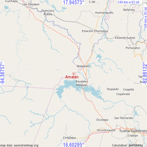
Amatán GPS coordinates[2]
17° 16' 32.016" North, 93° 41' 3.984" West
| Map corner | latitude | longitude |
|---|---|---|
| Upper-left | 17.94573°, | -94.38757° |
| Center: | 17.27556°, | -93.68444° |
| Lower-right: | 16.60295°, | -92.98132° |
| Map W x H: | 149.3×149.3 km | = 92.8×92.8mi |
| max Lat: | 32.7° ⇑85.6% North |
| Amatán: | 17.27556° |
| min Lat: | ⇓14.4% South 14.53588° |
| min Long | Amatán | max Long |
| -117.105° | -93.68444° | -86.73105° |
| W 86.3%⇐ | ⇒13.7% E |
Elevation
Elevation of Amatán is 156 m = 512 ft, and this is 1097.7 m = 3601 ft below average elevation for this country.
| Max E: |
3497 m = 11473 ft | 76.9% |
| Avg. | 1253.7 m = 4113 ft | |
| Amatán | 156 m = 512 ft | |
Min E: |
-1 m = -3 ft | 23.1% |
See also: Mexico elevation on elevation.city.
Geographical zone
Amatán is located in North Torrid zone (between Equator and Tropic of Cancer). Distance of this Northern Tropic circle is 685.1 km =425.7 mi to North.| Distance of | km | miles | from Amatán |
|---|---|---|---|
| North Pole | 8086.2 | 5024.5 | to North |
| Arctic Circle | 5480.3 | 3405.3 | to North |
| Tropic Cancer | 685.1 | 425.7 | to North |
| Equator | 1920.9 | 1193.6 | to South |


Nearby cities:
15 places around Amatán: (largest is in red/bold)
• Adolfo López Mateos
22.8 km =14.2 mi,  106°
106°
• Angel Albino Corzo
9.2 km =5.7 mi,  133°
133°
• Campamento General Emiliano Zapata
13.1 km =8.1 mi,  81°
81°
• Chimalapa 2da. Sección
16 km =9.9 mi,  20°
20°
• El Progreso (Chintul)
11.6 km =7.2 mi, 110°
• Esperanza de los Pobres
21.7 km =13.5 mi, 79°
• Felipe Ángeles
16.9 km =10.5 mi,  283°
283°
• Juan Sabines Gutiérrez
28.7 km =17.8 mi,  98°
98°
• Licenciado Luis Echeverría Álvarez (Playa Santa)
5.1 km =3.2 mi,  27°
27°
• Miguel Hidalgo y Costilla
25.1 km =15.6 mi,  91°
91°
• Nuevo México
13.4 km =8.3 mi,  124°
124°
• Nuevo Naranjo
29.9 km =18.6 mi, 116°
• Raudales Malpaso
12.8 km =8 mi,  139°
139°
• Rómulo Calzada (La Herradura)
15.7 km =9.8 mi,  62°
62°
• Santos Degollado
15.9 km =9.9 mi, 61°
Sources, notices
• [Note1] Compared only with cities in Mexico existing in our database
• [Src1] Map data: © OpenStreetMap contributors (CC-BY-SA)
• [Src2] Other city data from geonames.org with taken over terms of usage.
• [Src3] Geographical zone / Annual Mean Temperature by Robert A. Rohde @ Wikipedia
