La Esperanza geodata
La Esperanza (Oaxaca) is a populated place; located in Mexico in America/Mexico_City (GMT-6) time zone. With population of 725 people, there are 12042 cities with bigger population in this country. Compared to other cities in Mexico, 87.6% of cities are located further ↑North; 85.9% of cities are located further ←West and 70.4% of cities have higher elevation than La Esperanza. Note1


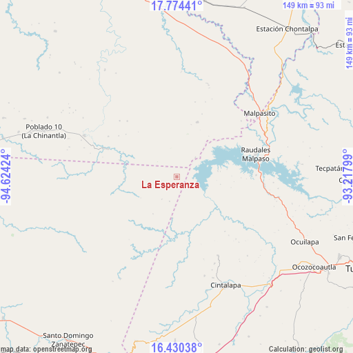
La Esperanza GPS coordinates[2]
17° 6' 12.996" North, 93° 55' 15.996" West
| Map corner | latitude | longitude |
|---|---|---|
| Upper-left | 17.77441°, | -94.62424° |
| Center: | 17.10361°, | -93.92111° |
| Lower-right: | 16.43038°, | -93.21799° |
| Map W x H: | 149.4×149.4 km | = 92.8×92.8mi |
| max Lat: | 32.7° ⇑87.6% North |
| La Esperanza: | 17.10361° |
| min Lat: | ⇓12.4% South 14.53588° |
| min Long | La Esperanza | max Long |
| -117.105° | -93.92111° | -86.73105° |
| W 85.9%⇐ | ⇒14.1% E |
Elevation
Elevation of La Esperanza is 400 m = 1312 ft, and this is 853.7 m = 2801 ft below average elevation for this country.
| Max E: |
3497 m = 11473 ft | 70.4% |
| Avg. | 1253.7 m = 4113 ft | |
| La Esperanza | 400 m = 1312 ft | |
Min E: |
-1 m = -3 ft | 29.6% |
See also: Mexico elevation on elevation.city.
Geographical zone
La Esperanza is located in North Torrid zone (between Equator and Tropic of Cancer). Distance of this Northern Tropic circle is 704.2 km =437.6 mi to North.| Distance of | km | miles | from La Esperanza |
|---|---|---|---|
| North Pole | 8105.3 | 5036.4 | to North |
| Arctic Circle | 5499.4 | 3417.2 | to North |
| Tropic Cancer | 704.2 | 437.6 | to North |
| Equator | 1901.7 | 1181.7 | to South |


Nearby cities:
15 places around La Esperanza: (largest is in red/bold)
• Adolfo López Mateos
33.4 km =20.8 mi,  138°
138°
• Amatán
31.6 km =19.6 mi,  52°
52°
• Angel Albino Corzo
34.3 km =21.3 mi,  68°
68°
• Cal y Mayor
18.7 km =11.6 mi,  212°
212°
• El Progreso (Chintul)
39 km =24.2 mi, 67°
• Felipe Ángeles
24.6 km =15.3 mi,  20°
20°
• Francisco I. Madero
37.6 km =23.4 mi,  152°
152°
• Helio García Alfaro
42.7 km =26.5 mi,  293°
293°
• Juan de Grijalva
43.3 km =26.9 mi,  96°
96°
• La Horqueta (Poblado Doce)
32.2 km =20 mi, 291°
• Licenciado Luis Echeverría Álvarez (Playa Santa)
36.2 km =22.5 mi, 49°
• Nuevo México
38 km =23.6 mi, 72°
• Raudales Malpaso
34.8 km =21.6 mi, 74°
• San Francisco la Paz
22.1 km =13.7 mi,  267°
267°
• Triunfo de Madero
40.1 km =24.9 mi,  156°
156°
Sources, notices
• [Note1] Compared only with cities in Mexico existing in our database
• [Src1] Map data: © OpenStreetMap contributors (CC-BY-SA)
• [Src2] Other city data from geonames.org with taken over terms of usage.
• [Src3] Geographical zone / Annual Mean Temperature by Robert A. Rohde @ Wikipedia
