Loma San Juan geodata
Loma San Juan (Oaxaca) is a populated place; located in Mexico in America/Mexico_City (GMT-6) time zone. With population of 996 people, there are 8744 cities with bigger population in this country. Compared to other cities in Mexico, 77.6% of cities are located further ↑North; 79.4% of cities are located further ←West and 77.4% of cities have higher elevation than Loma San Juan. Note1


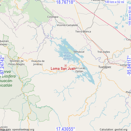
Loma San Juan GPS coordinates[2]
18° 6' 0.504" North, 96° 32' 39.444" West
| Map corner | latitude | longitude |
|---|---|---|
| Upper-left | 18.76718°, | -97.24742° |
| Center: | 18.10014°, | -96.54429° |
| Lower-right: | 17.43055°, | -95.84117° |
| Map W x H: | 148.6×148.6 km | = 92.3×92.3mi |
| max Lat: | 32.7° ⇑77.6% North |
| Loma San Juan: | 18.10014° |
| min Lat: | ⇓22.4% South 14.53588° |
| min Long | Loma San Juan | max Long |
| -117.105° | -96.54429° | -86.73105° |
| W 79.4%⇐ | ⇒20.6% E |
Elevation
Elevation of Loma San Juan is 143 m = 469 ft, and this is 1110.7 m = 3644 ft below average elevation for this country.
| Max E: |
3497 m = 11473 ft | 77.4% |
| Avg. | 1253.7 m = 4113 ft | |
| Loma San Juan | 143 m = 469 ft | |
Min E: |
-1 m = -3 ft | 22.6% |
See also: Mexico elevation on elevation.city.
Geographical zone
Loma San Juan is located in North Torrid zone (between Equator and Tropic of Cancer). Distance of this Northern Tropic circle is 593.4 km =368.7 mi to North.| Distance of | km | miles | from Loma San Juan |
|---|---|---|---|
| North Pole | 7994.5 | 4967.6 | to North |
| Arctic Circle | 5388.6 | 3348.3 | to North |
| Tropic Cancer | 593.4 | 368.7 | to North |
| Equator | 2012.5 | 1250.5 | to South |


Nearby cities:
15 places around Loma San Juan: (largest is in red/bold)
• Agua de Tierra (Sección la Montaña)
4.3 km =2.7 mi,  109°
109°
• Arroyo Espuma
4.4 km =2.7 mi,  186°
186°
• Arroyo Grande
4.9 km =3 mi,  91°
91°
• Arroyo Murciélago
5.1 km =3.2 mi,  356°
356°
• Arroyo Venado (Sección Tercera)
2.8 km =1.7 mi,  144°
144°
• Arroyo Zapotillo
2.6 km =1.6 mi,  179°
179°
• Camino de Ixcatlán
2.4 km =1.5 mi, 85°
• Colonia la Central
3.3 km =2.1 mi,  116°
116°
• El Progreso
2.9 km =1.8 mi, 355°
• La Permuta
5.9 km =3.7 mi,  95°
95°
• Los Zarates
3.4 km =2.1 mi,  78°
78°
• Playa Chica
5.1 km =3.2 mi,  147°
147°
• San Felipe Jalapa de Díaz
3.3 km =2.1 mi,  164°
164°
• San Pedro Ixcatlán
6.3 km =3.9 mi,  35°
35°
• Sección los Roques
4.2 km =2.6 mi, 83°
Sources, notices
• [Note1] Compared only with cities in Mexico existing in our database
• [Src1] Map data: © OpenStreetMap contributors (CC-BY-SA)
• [Src2] Other city data from geonames.org with taken over terms of usage.
• [Src3] Geographical zone / Annual Mean Temperature by Robert A. Rohde @ Wikipedia
