Jesús Nazareno (Rancho Nuevo) geodata
Jesús Nazareno (Rancho Nuevo) (Puebla) is a populated place; located in Mexico in America/Mexico_City (GMT-6) time zone. With population of 681 people, there are 12756 cities with bigger population in this country. Compared to other cities in Mexico, 66.8% of cities are located further ↑North; 70% of cities are located further ←West and 90.9% of cities have lower elevation than Jesús Nazareno (Rancho Nuevo). Note1
Current local time in Jesús Nazareno (Rancho Nuevo):
08:41 AM, MondayDifference from your time zone: hours


Jesús Nazareno (Rancho Nuevo) GPS coordinates[2]
18° 54' 21.996" North, 97° 27' 29.988" West
| Map corner | latitude | longitude |
|---|---|---|
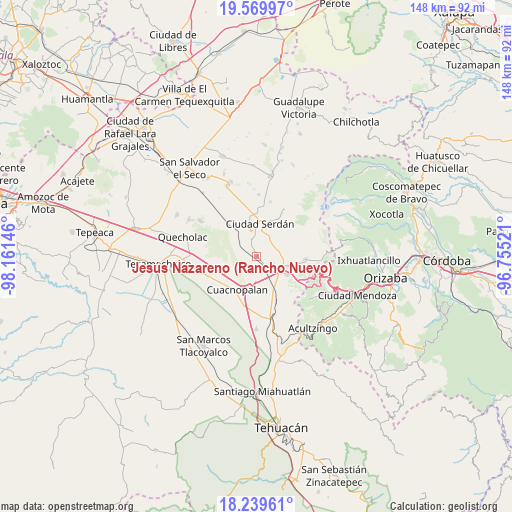
| Upper-left | 19.56997°, | -98.16146° |
| Center: | 18.90611°, | -97.45833° |
| Lower-right: | 18.23961°, | -96.75521° |
| Map W x H: | 147.9×147.9 km | = 91.9×91.9mi |
| max Lat: | 32.7° ⇑66.8% North |
| Jesús Nazareno (Rancho Nuevo): | 18.90611° |
| min Lat: | ⇓33.2% South 14.53588° |
| min Long | Jesús Nazareno | max Long |
| -117.105° | -97.45833° | -86.73105° |
| W 70%⇐ | ⇒30% E |
Elevation
Elevation of Jesús Nazareno (Rancho Nuevo) is 2436 m = 7992 ft, and this is 1182.3 m = 3879 ft above average elevation for this country.
| Max E: |
3497 m = 11473 ft | 9.1% |
| Jesús Nazareno (Rancho Nuevo) | 2436 m 7992 ft | |
| Avg. | 1253.7 m = 4113 ft | |
Min E: |
-1 m = -3 ft | 90.9% |
See also: Mexico elevation on elevation.city.
Geographical zone
Jesús Nazareno (Rancho Nuevo) is located in North Torrid zone (between Equator and Tropic of Cancer). Distance of this Northern Tropic circle is 503.8 km =313 mi to North.| Distance of | km | miles | from Jesús Nazareno (Rancho Nuevo) |
|---|---|---|---|
| North Pole | 7904.9 | 4911.9 | to North |
| Arctic Circle | 5299 | 3292.6 | to North |
| Tropic Cancer | 503.8 | 313 | to North |
| Equator | 2102.2 | 1306.2 | to South |


Nearby cities:
15 places around Jesús Nazareno (Rancho Nuevo): (largest is in red/bold)
• Amozoquillo Piletas
10.2 km =6.3 mi,  141°
141°
• Bellavista de Victoria (San José Bellavista)
9.6 km =6 mi,  249°
249°
• Ciudad Serdán
9.3 km =5.8 mi,  7°
7°
• Cuesta Blanca
6.8 km =4.2 mi,  188°
188°
• El Veladero
7 km =4.3 mi,  338°
338°
• Esperanza
10.1 km =6.3 mi,  121°
121°
• Las Palmas
6.1 km =3.8 mi,  298°
298°
• Los Ricardos
2.9 km =1.8 mi,  104°
104°
• Otilio Montaño
9.5 km =5.9 mi,  107°
107°
• San Antonio de Abajo
10.4 km =6.5 mi, 102°
• San Pedro Temamatla
6 km =3.7 mi,  290°
290°
• Santa Catarina los Reyes
3.5 km =2.2 mi, 139°
• Santa María Techachalco
5.4 km =3.4 mi,  346°
346°
• Tehuitzo
9.4 km =5.8 mi,  166°
166°
• Álvaro Obregón
3.5 km =2.2 mi,  93°
93°
Sources, notices
• [Note1] Compared only with cities in Mexico existing in our database
• [Src1] Map data: © OpenStreetMap contributors (CC-BY-SA)
• [Src2] Other city data from geonames.org with taken over terms of usage.
• [Src3] Geographical zone / Annual Mean Temperature by Robert A. Rohde @ Wikipedia
