Las Palmas geodata
Las Palmas (Puebla) is a populated place; located in Mexico in America/Mexico_City (GMT-6) time zone. With population of 650 people, there are 13331 cities with bigger population in this country. Compared to other cities in Mexico, 66.3% of cities are located further ↑North; 69.4% of cities are located further ←West and 90.8% of cities have lower elevation than Las Palmas. Note1


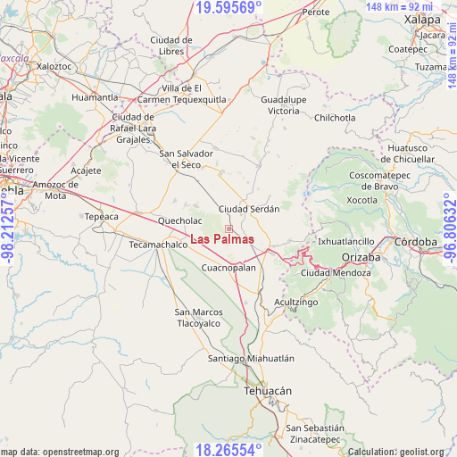
Las Palmas GPS coordinates[2]
18° 55' 54.984" North, 97° 30' 33.984" West
| Map corner | latitude | longitude |
|---|---|---|
| Upper-left | 19.59569°, | -98.21257° |
| Center: | 18.93194°, | -97.50944° |
| Lower-right: | 18.26554°, | -96.80632° |
| Map W x H: | 147.9×147.9 km | = 91.9×91.9mi |
| max Lat: | 32.7° ⇑66.3% North |
| Las Palmas: | 18.93194° |
| min Lat: | ⇓33.7% South 14.53588° |
| min Long | Las Palmas | max Long |
| -117.105° | -97.50944° | -86.73105° |
| W 69.4%⇐ | ⇒30.6% E |
Elevation
Elevation of Las Palmas is 2433 m = 7982 ft, and this is 1179.3 m = 3869 ft above average elevation for this country.
| Max E: |
3497 m = 11473 ft | 9.2% |
| Las Palmas | 2433 m 7982 ft | |
| Avg. | 1253.7 m = 4113 ft | |
Min E: |
-1 m = -3 ft | 90.8% |
See also: Mexico elevation on elevation.city.
Geographical zone
Las Palmas is located in North Torrid zone (between Equator and Tropic of Cancer). Distance of this Northern Tropic circle is 500.9 km =311.2 mi to North.| Distance of | km | miles | from Las Palmas |
|---|---|---|---|
| North Pole | 7902 | 4910.1 | to North |
| Arctic Circle | 5296.1 | 3290.8 | to North |
| Tropic Cancer | 500.9 | 311.2 | to North |
| Equator | 2105 | 1308 | to South |


Nearby cities:
15 places around Las Palmas: (largest is in red/bold)
• Bellavista de Victoria (San José Bellavista)
7.2 km =4.5 mi,  210°
210°
• Ciudad Serdán
9.1 km =5.7 mi,  46°
46°
• Cuesta Blanca
10.6 km =6.6 mi,  155°
155°
• El Veladero
4.5 km =2.8 mi,  37°
37°
• Guadalupe Enríquez
9.3 km =5.8 mi,  242°
242°
• Jesús Nazareno (Rancho Nuevo)
6.1 km =3.8 mi,  118°
118°
• Los Ricardos
8.9 km =5.5 mi,  113°
113°
• Palmar de Bravo
11.4 km =7.1 mi,  200°
200°
• San Isidro Monterrosas
10.9 km =6.8 mi,  219°
219°
• San José Guerrero
7.5 km =4.7 mi,  336°
336°
• San Pedro Temamatla
0.8 km =0.5 mi, 200°
• Santa Catarina los Reyes
9.5 km =5.9 mi,  125°
125°
• Santa Cruz Monterrosas
8.3 km =5.2 mi, 221°
• Santa María Techachalco
4.8 km =3 mi,  59°
59°
• Álvaro Obregón
9.4 km =5.8 mi, 109°
Sources, notices
• [Note1] Compared only with cities in Mexico existing in our database
• [Src1] Map data: © OpenStreetMap contributors (CC-BY-SA)
• [Src2] Other city data from geonames.org with taken over terms of usage.
• [Src3] Geographical zone / Annual Mean Temperature by Robert A. Rohde @ Wikipedia
