Las Palomas geodata
Las Palomas (Coahuila) is a populated place; located in Mexico in America/Monterrey (GMT-6) time zone. With population of 677 people, there are 12831 cities with bigger population in this country. Compared to other cities in Mexico, 92.3% of cities are located further ↓South; 87.3% of cities are located further →East and 56% of cities have higher elevation than Las Palomas. Note1


Las Palomas GPS coordinates[2]
25° 22' 21" North, 103° 20' 8.988" West
| Map corner | latitude | longitude |
|---|---|---|
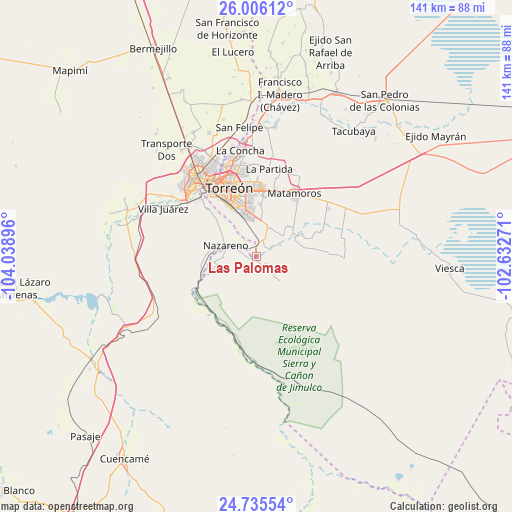
| Upper-left | 26.00612°, | -104.03896° |
| Center: | 25.3725°, | -103.33583° |
| Lower-right: | 24.73554°, | -102.63271° |
| Map W x H: | 141.3×141.3 km | = 87.8×87.8mi |
| max Lat: | 32.7° ⇑7.7% North |
| Las Palomas: | 25.3725° |
| min Lat: | ⇓92.3% South 14.53588° |
| min Long | Las Palomas | max Long |
| -117.105° | -103.33583° | -86.73105° |
| W 12.7%⇐ | ⇒87.3% E |
Elevation
Elevation of Las Palomas is 1158 m = 3799 ft, and this is 95.7 m = 314 ft below average elevation for this country.
| Max E: |
3497 m = 11473 ft | 56% |
| Avg. | 1253.7 m = 4113 ft | |
| Las Palomas | 1158 m = 3799 ft | |
Min E: |
-1 m = -3 ft | 44% |
See also: Mexico elevation on elevation.city.
Geographical zone
Las Palomas is located in North temperate zone (between Tropic of Cancer and the Arctic Circle). Distance of this Northern Tropic circle is 215.2 km =133.7 mi to South.| Distance of | km | miles | from Las Palomas |
|---|---|---|---|
| North Pole | 7185.9 | 4465.1 | to North |
| Arctic Circle | 4580 | 2845.9 | to North |
| Tropic Cancer | 215.2 | 133.7 | to South |
| Equator | 2821.2 | 1753 | to South |


Nearby cities:
15 places around Las Palomas: (largest is in red/bold)
• Boquilla de las Perlas
6.8 km =4.2 mi,  136°
136°
• Gilita
13.9 km =8.6 mi,  80°
80°
• Gregorio García (El Taconazo)
11.7 km =7.3 mi,  133°
133°
• La Perla
13.9 km =8.6 mi,  353°
353°
• La Rosita
11.3 km =7 mi,  66°
66°
• Las Mieleras
7.5 km =4.7 mi, 66°
• Nazareno
9 km =5.6 mi,  289°
289°
• Nuevo Mieleras
7.6 km =4.7 mi,  0°
0°
• Picardías
16 km =9.9 mi,  250°
250°
• Rancho Alegre
14.5 km =9 mi, 3°
• San Isidro
0.6 km =0.4 mi,  193°
193°
• San Pedro
13.7 km =8.5 mi,  60°
60°
• Santo Niño Aguanaval
8.7 km =5.4 mi,  41°
41°
• Tejabán del Esfuerzo (El Esfuerzo)
13.4 km =8.3 mi, 132°
• Ventana
15.1 km =9.4 mi, 250°
Sources, notices
• [Note1] Compared only with cities in Mexico existing in our database
• [Src1] Map data: © OpenStreetMap contributors (CC-BY-SA)
• [Src2] Other city data from geonames.org with taken over terms of usage.
• [Src3] Geographical zone / Annual Mean Temperature by Robert A. Rohde @ Wikipedia
