Miguel Hidalgo geodata
Miguel Hidalgo (Chiapas) is a populated place; located in Mexico in America/Mexico_City (GMT-6) time zone. With population of 658 people, there are 13187 cities with bigger population in this country. Compared to other cities in Mexico, 93.9% of cities are located further ↑North; 86.3% of cities are located further ←West and 67.7% of cities have higher elevation than Miguel Hidalgo. Note1


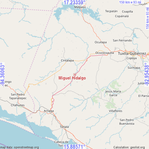
Miguel Hidalgo GPS coordinates[2]
16° 33' 38.988" North, 93° 39' 27" West
| Map corner | latitude | longitude |
|---|---|---|
| Upper-left | 17.23359°, | -94.36063° |
| Center: | 16.56083°, | -93.6575° |
| Lower-right: | 15.88571°, | -92.95438° |
| Map W x H: | 149.9×149.9 km | = 93.1×93.1mi |
| max Lat: | 32.7° ⇑93.9% North |
| Miguel Hidalgo: | 16.56083° |
| min Lat: | ⇓6.1% South 14.53588° |
| min Long | Miguel Hidalgo | max Long |
| -117.105° | -93.6575° | -86.73105° |
| W 86.3%⇐ | ⇒13.7% E |
Elevation
Elevation of Miguel Hidalgo is 545 m = 1788 ft, and this is 708.7 m = 2325 ft below average elevation for this country.
| Max E: |
3497 m = 11473 ft | 67.7% |
| Avg. | 1253.7 m = 4113 ft | |
| Miguel Hidalgo | 545 m = 1788 ft | |
Min E: |
-1 m = -3 ft | 32.3% |
See also: Mexico elevation on elevation.city.
Geographical zone
Miguel Hidalgo is located in North Torrid zone (between Equator and Tropic of Cancer). Distance of this Northern Tropic circle is 764.5 km =475 mi to North.| Distance of | km | miles | from Miguel Hidalgo |
|---|---|---|---|
| North Pole | 8165.7 | 5073.9 | to North |
| Arctic Circle | 5559.8 | 3454.7 | to North |
| Tropic Cancer | 764.5 | 475 | to North |
| Equator | 1841.4 | 1144.2 | to South |


Nearby cities:
15 places around Miguel Hidalgo: (largest is in red/bold)
• Cereso 14 (El Amate)
15.9 km =9.9 mi,  283°
283°
• Cintalapa de Figueroa
15.1 km =9.4 mi,  334°
334°
• Cristóbal Colón
7.5 km =4.7 mi,  79°
79°
• Cuauhtémoc
6.4 km =4 mi,  259°
259°
• El Triunfo
14.7 km =9.1 mi,  223°
223°
• Jiquipilas
12 km =7.5 mi,  5°
5°
• José María Pino Suárez
10.6 km =6.6 mi,  234°
234°
• Julián Grajales
15.8 km =9.8 mi,  202°
202°
• Luis Espinosa
13.1 km =8.1 mi,  144°
144°
• Lázaro Cárdenas
15.1 km =9.4 mi,  288°
288°
• Nueva Palestina
8 km =5 mi,  161°
161°
• Quintana Roo
11.4 km =7.1 mi,  63°
63°
• Sinaloa
5.2 km =3.2 mi,  37°
37°
• Unión Agrarista
9.7 km =6 mi,  193°
193°
• Vicente Guerrero
13.6 km =8.5 mi, 35°
Sources, notices
• [Note1] Compared only with cities in Mexico existing in our database
• [Src1] Map data: © OpenStreetMap contributors (CC-BY-SA)
• [Src2] Other city data from geonames.org with taken over terms of usage.
• [Src3] Geographical zone / Annual Mean Temperature by Robert A. Rohde @ Wikipedia
