Cereso 14 (El Amate) geodata
Cereso 14 (El Amate) (Chiapas) is a populated place; located in Mexico in America/Mexico_City (GMT-6) time zone. With population of 2,243 people, there are 3920 cities with bigger population in this country. Compared to other cities in Mexico, 93.7% of cities are located further ↑North; 86.1% of cities are located further ←West and 66.5% of cities have higher elevation than Cereso 14 (El Amate). Note1
Current local time in Cereso 14 (El Amate):
07:06 AM, WednesdayDifference from your time zone: hours


Cereso 14 (El Amate) GPS coordinates[2]
16° 35' 40.992" North, 93° 48' 10.008" West
| Map corner | latitude | longitude |
|---|---|---|
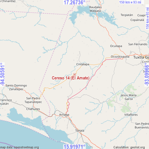
| Upper-left | 17.26736°, | -94.50591° |
| Center: | 16.59472°, | -93.80278° |
| Lower-right: | 15.91971°, | -93.09966° |
| Map W x H: | 149.8×149.8 km | = 93.1×93.1mi |
| max Lat: | 32.7° ⇑93.7% North |
| Cereso 14 (El Amate): | 16.59472° |
| min Lat: | ⇓6.3% South 14.53588° |
| min Long | Cereso 14 (El A | max Long |
| -117.105° | -93.80278° | -86.73105° |
| W 86.1%⇐ | ⇒13.9% E |
Elevation
Elevation of Cereso 14 (El Amate) is 612 m = 2008 ft, and this is 641.7 m = 2105 ft below average elevation for this country.
| Max E: |
3497 m = 11473 ft | 66.5% |
| Avg. | 1253.7 m = 4113 ft | |
| Cereso 14 (El Amate) | 612 m = 2008 ft | |
Min E: |
-1 m = -3 ft | 33.5% |
See also: Mexico elevation on elevation.city.
Geographical zone
Cereso 14 (El Amate) is located in North Torrid zone (between Equator and Tropic of Cancer). Distance of this Northern Tropic circle is 760.8 km =472.7 mi to North.| Distance of | km | miles | from Cereso 14 (El Amate) |
|---|---|---|---|
| North Pole | 8161.9 | 5071.6 | to North |
| Arctic Circle | 5556 | 3452.3 | to North |
| Tropic Cancer | 760.8 | 472.7 | to North |
| Equator | 1845.2 | 1146.6 | to South |


Nearby cities:
15 places around Cereso 14 (El Amate): (largest is in red/bold)
• Abelardo L. Rodríguez
8.2 km =5.1 mi,  1°
1°
• Baja California
18 km =11.2 mi,  177°
177°
• Chiapas Nuevo
15.7 km =9.8 mi,  189°
189°
• Cintalapa de Figueroa
13.4 km =8.3 mi,  42°
42°
• Cuauhtémoc
10.5 km =6.5 mi,  118°
118°
• El Triunfo
15.5 km =9.6 mi,  159°
159°
• Emiliano Zapata
14.7 km =9.1 mi,  356°
356°
• Jacinto Tirado
13.8 km =8.6 mi,  11°
11°
• José María Pino Suárez
12 km =7.5 mi,  145°
145°
• Lázaro Cárdenas
1.6 km =1 mi,  49°
49°
• Miguel Hidalgo
15.9 km =9.9 mi,  103°
103°
• Mérida
3.4 km =2.1 mi,  206°
206°
• Pomposo Castellanos
6.8 km =4.2 mi,  265°
265°
• Tehuacán
17 km =10.6 mi, 269°
• Villamorelos
18.4 km =11.4 mi,  226°
226°
Sources, notices
• [Note1] Compared only with cities in Mexico existing in our database
• [Src1] Map data: © OpenStreetMap contributors (CC-BY-SA)
• [Src2] Other city data from geonames.org with taken over terms of usage.
• [Src3] Geographical zone / Annual Mean Temperature by Robert A. Rohde @ Wikipedia
