Copalo (Chalco) geodata
Copalo (Chalco) (San Luis Potosí) is a populated place; located in Mexico in America/Mexico_City (GMT-6) time zone. With population of 635 people, there are 13639 cities with bigger population in this country. Compared to other cities in Mexico, 80.7% of cities are located further ↓South; 53.4% of cities are located further ←West and 77.9% of cities have higher elevation than Copalo (Chalco). Note1


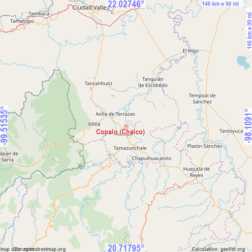
Copalo (Chalco) GPS coordinates[2]
21° 22' 27.012" North, 98° 48' 43.992" West
| Map corner | latitude | longitude |
|---|---|---|
| Upper-left | 22.02746°, | -99.51535° |
| Center: | 21.37417°, | -98.81222° |
| Lower-right: | 20.71795°, | -98.1091° |
| Map W x H: | 145.6×145.6 km | = 90.5×90.5mi |
| max Lat: | 32.7° ⇑19.3% North |
| Copalo (Chalco): | 21.37417° |
| min Lat: | ⇓80.7% South 14.53588° |
| min Long | Copalo (Chalco) | max Long |
| -117.105° | -98.81222° | -86.73105° |
| W 53.4%⇐ | ⇒46.6% E |
Elevation
Elevation of Copalo (Chalco) is 132 m = 433 ft, and this is 1121.7 m = 3680 ft below average elevation for this country.
| Max E: |
3497 m = 11473 ft | 77.9% |
| Avg. | 1253.7 m = 4113 ft | |
| Copalo (Chalco) | 132 m = 433 ft | |
Min E: |
-1 m = -3 ft | 22.1% |
See also: Mexico elevation on elevation.city.
Geographical zone
Copalo (Chalco) is located in North Torrid zone (between Equator and Tropic of Cancer). Distance of this Northern Tropic circle is 229.3 km =142.5 mi to North.| Distance of | km | miles | from Copalo (Chalco) |
|---|---|---|---|
| North Pole | 7630.5 | 4741.4 | to North |
| Arctic Circle | 5024.6 | 3122.1 | to North |
| Tropic Cancer | 229.3 | 142.5 | to North |
| Equator | 2376.6 | 1476.8 | to South |


Nearby cities:
15 places around Copalo (Chalco): (largest is in red/bold)
• Ahuehueyo Primero Centro
4.1 km =2.5 mi,  218°
218°
• Barrio de Arriba
5 km =3.1 mi,  200°
200°
• Barrio de En Medio
4.8 km =3 mi,  211°
211°
• Chililillo
6.7 km =4.2 mi,  67°
67°
• Cuixcoatitla (Chalco)
1.2 km =0.7 mi,  163°
163°
• Ensenada (Chalco)
2 km =1.2 mi,  36°
36°
• Jalpilla
6.7 km =4.2 mi,  291°
291°
• Las Cuevas
6.6 km =4.1 mi,  259°
259°
• Matlapa
4.5 km =2.8 mi, 201°
• Nexcuayo II
5.6 km =3.5 mi, 162°
• Papatlas
1.6 km =1 mi,  120°
120°
• Picholco
4.5 km =2.8 mi, 289°
• San Antonio
3.8 km =2.4 mi,  175°
175°
• Temalacaco
5.7 km =3.5 mi,  320°
320°
• Totomoxtla (La Ceiba)
5 km =3.1 mi,  86°
86°
Sources, notices
• [Note1] Compared only with cities in Mexico existing in our database
• [Src1] Map data: © OpenStreetMap contributors (CC-BY-SA)
• [Src2] Other city data from geonames.org with taken over terms of usage.
• [Src3] Geographical zone / Annual Mean Temperature by Robert A. Rohde @ Wikipedia
