Ahuehueyo Primero Centro geodata
Ahuehueyo Primero Centro (San Luis Potosí) is a populated place; located in Mexico in America/Mexico_City (GMT-6) time zone. With population of 1,095 people, there are 7940 cities with bigger population in this country. Compared to other cities in Mexico, 80.4% of cities are located further ↓South; 53% of cities are located further ←West and 77.6% of cities have higher elevation than Ahuehueyo Primero Centro. Note1
Current local time in Ahuehueyo Primero Centro:
08:09 AM, WednesdayDifference from your time zone: hours


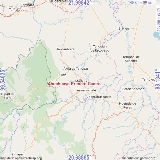
Ahuehueyo Primero Centro GPS coordinates[2]
21° 20' 42" North, 98° 50' 13.992" West
| Map corner | latitude | longitude |
|---|---|---|
| Upper-left | 21.99842°, | -99.54035° |
| Center: | 21.345°, | -98.83722° |
| Lower-right: | 20.68865°, | -98.1341° |
| Map W x H: | 145.6×145.6 km | = 90.5×90.5mi |
| max Lat: | 32.7° ⇑19.6% North |
| Ahuehueyo Primero Centro: | 21.345° |
| min Lat: | ⇓80.4% South 14.53588° |
| min Long | Ahuehueyo Prime | max Long |
| -117.105° | -98.83722° | -86.73105° |
| W 53%⇐ | ⇒47% E |
Elevation
Elevation of Ahuehueyo Primero Centro is 140 m = 459 ft, and this is 1113.7 m = 3654 ft below average elevation for this country.
| Max E: |
3497 m = 11473 ft | 77.6% |
| Avg. | 1253.7 m = 4113 ft | |
| Ahuehueyo Primero Centro | 140 m = 459 ft | |
Min E: |
-1 m = -3 ft | 22.4% |
See also: Mexico elevation on elevation.city.
Geographical zone
Ahuehueyo Primero Centro is located in North Torrid zone (between Equator and Tropic of Cancer). Distance of this Northern Tropic circle is 232.6 km =144.5 mi to North.| Distance of | km | miles | from Ahuehueyo Primero Centro |
|---|---|---|---|
| North Pole | 7633.7 | 4743.4 | to North |
| Arctic Circle | 5027.8 | 3124.1 | to North |
| Tropic Cancer | 232.6 | 144.5 | to North |
| Equator | 2373.3 | 1474.7 | to South |


Nearby cities:
15 places around Ahuehueyo Primero Centro: (largest is in red/bold)
• Atlamaxátl
4 km =2.5 mi,  161°
161°
• Barrio de Arriba
1.6 km =1 mi,  149°
149°
• Barrio de En Medio
0.9 km =0.6 mi,  174°
174°
• Chalchocoyo
5.8 km =3.6 mi,  125°
125°
• Copalo (Chalco)
4.1 km =2.5 mi,  38°
38°
• Cuixcoatitla (Chalco)
3.6 km =2.2 mi,  54°
54°
• Las Cuevas
4.4 km =2.7 mi,  298°
298°
• Matlapa
1.4 km =0.9 mi, 134°
• Nexcuayo II
4.8 km =3 mi,  116°
116°
• Papatlas
4.7 km =2.9 mi,  58°
58°
• Picholco
5.1 km =3.2 mi,  340°
340°
• San Antonio
2.9 km =1.8 mi,  99°
99°
• Tenexio
5.6 km =3.5 mi,  308°
308°
• Tepetzintla
4.7 km =2.9 mi, 158°
• Xochititla
4.6 km =2.9 mi,  141°
141°
Sources, notices
• [Note1] Compared only with cities in Mexico existing in our database
• [Src1] Map data: © OpenStreetMap contributors (CC-BY-SA)
• [Src2] Other city data from geonames.org with taken over terms of usage.
• [Src3] Geographical zone / Annual Mean Temperature by Robert A. Rohde @ Wikipedia
