Atexcalco geodata
Atexcalco (Veracruz) is a populated place; located in Mexico in America/Mexico_City (GMT-6) time zone. With population of 634 people, there are 13664 cities with bigger population in this country. Compared to other cities in Mexico, 70.1% of cities are located further ↑North; 72.7% of cities are located further ←West and 91.5% of cities have lower elevation than Atexcalco. Note1


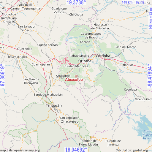
Atexcalco GPS coordinates[2]
18° 42' 51.012" North, 97° 10' 59.016" West
| Map corner | latitude | longitude |
|---|---|---|
| Upper-left | 19.3788°, | -97.88619° |
| Center: | 18.71417°, | -97.18306° |
| Lower-right: | 18.04692°, | -96.47994° |
| Map W x H: | 148.1×148.1 km | = 92×92mi |
| max Lat: | 32.7° ⇑70.1% North |
| Atexcalco: | 18.71417° |
| min Lat: | ⇓29.9% South 14.53588° |
| min Long | Atexcalco | max Long |
| -117.105° | -97.18306° | -86.73105° |
| W 72.7%⇐ | ⇒27.3% E |
Elevation
Elevation of Atexcalco is 2460 m = 8071 ft, and this is 1206.3 m = 3958 ft above average elevation for this country.
| Max E: |
3497 m = 11473 ft | 8.5% |
| Atexcalco | 2460 m 8071 ft | |
| Avg. | 1253.7 m = 4113 ft | |
Min E: |
-1 m = -3 ft | 91.5% |
See also: Mexico elevation on elevation.city.
Geographical zone
Atexcalco is located in North Torrid zone (between Equator and Tropic of Cancer). Distance of this Northern Tropic circle is 525.1 km =326.3 mi to North.| Distance of | km | miles | from Atexcalco |
|---|---|---|---|
| North Pole | 7926.2 | 4925.1 | to North |
| Arctic Circle | 5320.4 | 3305.9 | to North |
| Tropic Cancer | 525.1 | 326.3 | to North |
| Equator | 2080.8 | 1292.9 | to South |


Nearby cities:
15 places around Atexcalco: (largest is in red/bold)
• Acatla
5.4 km =3.4 mi,  316°
316°
• Acultzinapa
3.1 km =1.9 mi,  188°
188°
• Huitzila
1.4 km =0.9 mi,  68°
68°
• Huixtitla
4.3 km =2.7 mi,  344°
344°
• Mexcala
2.8 km =1.7 mi,  136°
136°
• Monterrey
4.8 km =3 mi,  53°
53°
• Soledad Atzompa
1.3 km =0.8 mi,  353°
353°
• Soledad Atzompa
5.7 km =3.5 mi,  37°
37°
• Tepaxapa
5.9 km =3.7 mi,  179°
179°
• Tetlatzinga
2.2 km =1.4 mi, 183°
• Tlalpan
4.1 km =2.5 mi, 36°
• Tlatilpa
4.6 km =2.9 mi,  61°
61°
• Tlatzala
4.7 km =2.9 mi, 70°
• Xiquila
1.2 km =0.7 mi,  247°
247°
• Xonotla
4.7 km =2.9 mi, 45°
Sources, notices
• [Note1] Compared only with cities in Mexico existing in our database
• [Src1] Map data: © OpenStreetMap contributors (CC-BY-SA)
• [Src2] Other city data from geonames.org with taken over terms of usage.
• [Src3] Geographical zone / Annual Mean Temperature by Robert A. Rohde @ Wikipedia
