Xonotla geodata
Xonotla (Veracruz) is a populated place; located in Mexico in America/Mexico_City (GMT-6) time zone. With population of 923 people, there are 9459 cities with bigger population in this country. Compared to other cities in Mexico, 69.6% of cities are located further ↑North; 73% of cities are located further ←West and 79.7% of cities have lower elevation than Xonotla. Note1


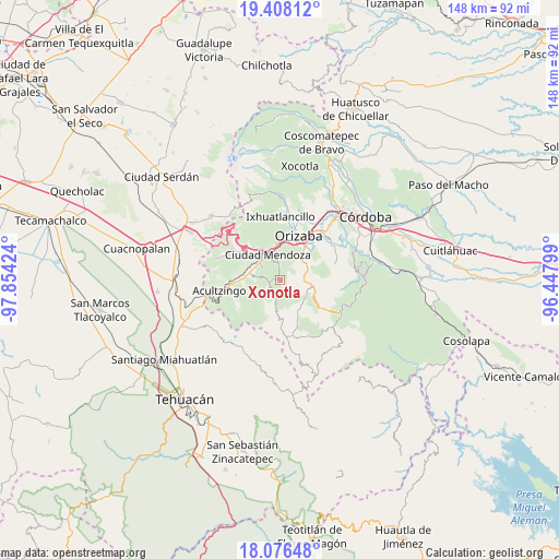
Xonotla GPS coordinates[2]
18° 44' 36.996" North, 97° 9' 3.996" West
| Map corner | latitude | longitude |
|---|---|---|
| Upper-left | 19.40812°, | -97.85424° |
| Center: | 18.74361°, | -97.15111° |
| Lower-right: | 18.07648°, | -96.44799° |
| Map W x H: | 148.1×148.1 km | = 92×92mi |
| max Lat: | 32.7° ⇑69.6% North |
| Xonotla: | 18.74361° |
| min Lat: | ⇓30.4% South 14.53588° |
| min Long | Xonotla | max Long |
| -117.105° | -97.15111° | -86.73105° |
| W 73%⇐ | ⇒27% E |
Elevation
Elevation of Xonotla is 2134 m = 7001 ft, and this is 880.3 m = 2888 ft above average elevation for this country.
| Max E: |
3497 m = 11473 ft | 20.3% |
| Xonotla | 2134 m 7001 ft | |
| Avg. | 1253.7 m = 4113 ft | |
Min E: |
-1 m = -3 ft | 79.7% |
See also: Mexico elevation on elevation.city.
Geographical zone
Xonotla is located in North Torrid zone (between Equator and Tropic of Cancer). Distance of this Northern Tropic circle is 521.8 km =324.2 mi to North.| Distance of | km | miles | from Xonotla |
|---|---|---|---|
| North Pole | 7923 | 4923.1 | to North |
| Arctic Circle | 5317.1 | 3303.9 | to North |
| Tropic Cancer | 521.8 | 324.2 | to North |
| Equator | 2084.1 | 1295 | to South |


Nearby cities:
15 places around Xonotla: (largest is in red/bold)
• Atexcalco
4.7 km =2.9 mi,  225°
225°
• Barrio de Tetzmola
2.9 km =1.8 mi,  356°
356°
• El Campanario
5.5 km =3.4 mi,  304°
304°
• Huitzila
3.4 km =2.1 mi,  216°
216°
• Huixtitla
4.6 km =2.9 mi,  280°
280°
• La Cuesta
5.5 km =3.4 mi,  341°
341°
• Mexcala
5.5 km =3.4 mi,  195°
195°
• Monterrey
0.6 km =0.4 mi,  126°
126°
• Necoxtla
3.9 km =2.4 mi, 356°
• Soledad Atzompa
1.3 km =0.8 mi,  3°
3°
• Soledad Atzompa
4 km =2.5 mi,  240°
240°
• Tlalpan
1 km =0.6 mi,  270°
270°
• Tlatilpa
1.3 km =0.8 mi,  145°
145°
• Tlatzala
2 km =1.2 mi, 147°
• Tzoncolco
4.3 km =2.7 mi,  37°
37°
Sources, notices
• [Note1] Compared only with cities in Mexico existing in our database
• [Src1] Map data: © OpenStreetMap contributors (CC-BY-SA)
• [Src2] Other city data from geonames.org with taken over terms of usage.
• [Src3] Geographical zone / Annual Mean Temperature by Robert A. Rohde @ Wikipedia
