De Rojas geodata
De Rojas (Puebla) is a populated place; located in Mexico in America/Mexico_City (GMT-6) time zone. With population of 607 people, there are 14186 cities with bigger population in this country. Compared to other cities in Mexico, 71% of cities are located further ↑North; 67.8% of cities are located further ←West and 68.8% of cities have lower elevation than De Rojas. Note1


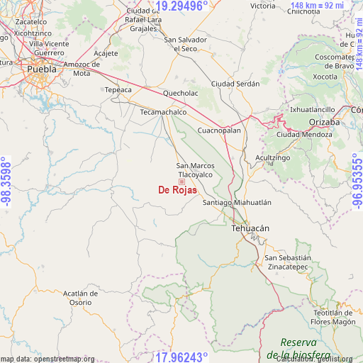
De Rojas GPS coordinates[2]
18° 37' 48" North, 97° 39' 24.012" West
| Map corner | latitude | longitude |
|---|---|---|
| Upper-left | 19.29496°, | -98.3598° |
| Center: | 18.63°, | -97.65667° |
| Lower-right: | 17.96243°, | -96.95355° |
| Map W x H: | 148.2×148.2 km | = 92.1×92.1mi |
| max Lat: | 32.7° ⇑71% North |
| De Rojas: | 18.63° |
| min Lat: | ⇓29% South 14.53588° |
| min Long | De Rojas | max Long |
| -117.105° | -97.65667° | -86.73105° |
| W 67.8%⇐ | ⇒32.2% E |
Elevation
Elevation of De Rojas is 1904 m = 6247 ft, and this is 650.3 m = 2134 ft above average elevation for this country.
| Max E: |
3497 m = 11473 ft | 31.2% |
| De Rojas | 1904 m 6247 ft | |
| Avg. | 1253.7 m = 4113 ft | |
Min E: |
-1 m = -3 ft | 68.8% |
See also: Mexico elevation on elevation.city.
Geographical zone
De Rojas is located in North Torrid zone (between Equator and Tropic of Cancer). Distance of this Northern Tropic circle is 534.5 km =332.1 mi to North.| Distance of | km | miles | from De Rojas |
|---|---|---|---|
| North Pole | 7935.6 | 4931 | to North |
| Arctic Circle | 5329.7 | 3311.7 | to North |
| Tropic Cancer | 534.5 | 332.1 | to North |
| Equator | 2071.5 | 1287.2 | to South |


Nearby cities:
15 places around De Rojas: (largest is in red/bold)
• Guadalupe Victoria
7.2 km =4.5 mi,  308°
308°
• Ignacio Zaragoza
3.8 km =2.4 mi,  271°
271°
• Pazoltepec
8.7 km =5.4 mi,  92°
92°
• Pericotepec
3.7 km =2.3 mi,  133°
133°
• San Andrés Cacaloapan
9 km =5.6 mi, 125°
• San José Buenavista
8.8 km =5.5 mi,  68°
68°
• San José Tlacuitlapan
9.2 km =5.7 mi,  20°
20°
• San Lucas el Viejo
8.3 km =5.2 mi, 309°
• San Marcos Tlacoyalco
7.4 km =4.6 mi,  48°
48°
• Santa María la Alta
3.4 km =2.1 mi,  182°
182°
• Santo Nombre
5.3 km =3.3 mi,  337°
337°
• Tecoxtle
3.4 km =2.1 mi, 54°
• Tepazolco
8.8 km =5.5 mi,  331°
331°
• Tepetlacolco
4 km =2.5 mi,  287°
287°
• Tlacotepec
5.8 km =3.6 mi,  0°
0°
Sources, notices
• [Note1] Compared only with cities in Mexico existing in our database
• [Src1] Map data: © OpenStreetMap contributors (CC-BY-SA)
• [Src2] Other city data from geonames.org with taken over terms of usage.
• [Src3] Geographical zone / Annual Mean Temperature by Robert A. Rohde @ Wikipedia
