San Lucas el Viejo geodata
San Lucas el Viejo (Puebla) is a populated place; located in Mexico in America/Mexico_City (GMT-6) time zone. With population of 1,494 people, there are 5780 cities with bigger population in this country. Compared to other cities in Mexico, 70.5% of cities are located further ↑North; 67% of cities are located further ←West and 69.9% of cities have lower elevation than San Lucas el Viejo. Note1


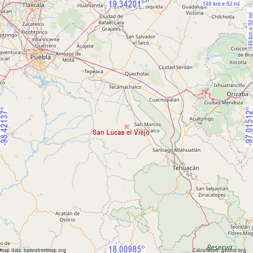
San Lucas el Viejo GPS coordinates[2]
18° 40' 38.064" North, 97° 43' 5.664" West
| Map corner | latitude | longitude |
|---|---|---|
| Upper-left | 19.34201°, | -98.42137° |
| Center: | 18.67724°, | -97.71824° |
| Lower-right: | 18.00985°, | -97.01512° |
| Map W x H: | 148.1×148.1 km | = 92×92mi |
| max Lat: | 32.7° ⇑70.5% North |
| San Lucas el Viejo: | 18.67724° |
| min Lat: | ⇓29.5% South 14.53588° |
| min Long | San Lucas el Vi | max Long |
| -117.105° | -97.71824° | -86.73105° |
| W 67%⇐ | ⇒33% E |
Elevation
Elevation of San Lucas el Viejo is 1922 m = 6306 ft, and this is 668.3 m = 2193 ft above average elevation for this country.
| Max E: |
3497 m = 11473 ft | 30.1% |
| San Lucas el Viejo | 1922 m 6306 ft | |
| Avg. | 1253.7 m = 4113 ft | |
Min E: |
-1 m = -3 ft | 69.9% |
See also: Mexico elevation on elevation.city.
Geographical zone
San Lucas el Viejo is located in North Torrid zone (between Equator and Tropic of Cancer). Distance of this Northern Tropic circle is 529.2 km =328.8 mi to North.| Distance of | km | miles | from San Lucas el Viejo |
|---|---|---|---|
| North Pole | 7930.3 | 4927.7 | to North |
| Arctic Circle | 5324.5 | 3308.5 | to North |
| Tropic Cancer | 529.2 | 328.8 | to North |
| Equator | 2076.7 | 1290.4 | to South |


Nearby cities:
15 places around San Lucas el Viejo: (largest is in red/bold)
• De Rojas
8.3 km =5.2 mi,  129°
129°
• Guadalupe Victoria
1.2 km =0.7 mi, 134°
• Ignacio Zaragoza
5.8 km =3.6 mi,  152°
152°
• Los Marías
7.7 km =4.8 mi,  50°
50°
• Rancho Chico
9.5 km =5.9 mi,  35°
35°
• San Gabriel Tetzoyocán
9 km =5.6 mi,  10°
10°
• San José Tlacuitlapan
10.3 km =6.4 mi,  70°
70°
• Santo Nombre
4.5 km =2.8 mi,  94°
94°
• Tecalzingo
6.3 km =3.9 mi, 50°
• Tecoxtle
9.9 km =6.2 mi,  109°
109°
• Tepazolco
3.4 km =2.1 mi, 42°
• Tepetlacolco
4.8 km =3 mi, 146°
• Tlacomulco
9.4 km =5.8 mi, 45°
• Tlacotepec
6.6 km =4.1 mi, 85°
• Xochitlan Todos Santos
6.8 km =4.2 mi,  295°
295°
Sources, notices
• [Note1] Compared only with cities in Mexico existing in our database
• [Src1] Map data: © OpenStreetMap contributors (CC-BY-SA)
• [Src2] Other city data from geonames.org with taken over terms of usage.
• [Src3] Geographical zone / Annual Mean Temperature by Robert A. Rohde @ Wikipedia
