San José Tlacuitlapan geodata
San José Tlacuitlapan (Puebla) is a populated place; located in Mexico in America/Mexico_City (GMT-6) time zone. With population of 1,016 people, there are 8570 cities with bigger population in this country. Compared to other cities in Mexico, 70.2% of cities are located further ↑North; 68.1% of cities are located further ←West and 74.1% of cities have lower elevation than San José Tlacuitlapan. Note1
Current local time in San José Tlacuitlapan:
06:48 AM, WednesdayDifference from your time zone: hours


San José Tlacuitlapan GPS coordinates[2]
18° 42' 27.468" North, 97° 37' 31.368" West
| Map corner | latitude | longitude |
|---|---|---|
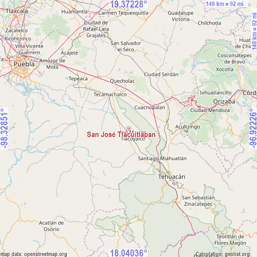
| Upper-left | 19.37228°, | -98.32851° |
| Center: | 18.70763°, | -97.62538° |
| Lower-right: | 18.04036°, | -96.92226° |
| Map W x H: | 148.1×148.1 km | = 92×92mi |
| max Lat: | 32.7° ⇑70.2% North |
| San José Tlacuitlapan: | 18.70763° |
| min Lat: | ⇓29.8% South 14.53588° |
| min Long | San José Tlacu | max Long |
| -117.105° | -97.62538° | -86.73105° |
| W 68.1%⇐ | ⇒31.9% E |
Elevation
Elevation of San José Tlacuitlapan is 2015 m = 6611 ft, and this is 761.3 m = 2498 ft above average elevation for this country.
| Max E: |
3497 m = 11473 ft | 25.9% |
| San José Tlacuitlapan | 2015 m 6611 ft | |
| Avg. | 1253.7 m = 4113 ft | |
Min E: |
-1 m = -3 ft | 74.1% |
See also: Mexico elevation on elevation.city.
Geographical zone
San José Tlacuitlapan is located in North Torrid zone (between Equator and Tropic of Cancer). Distance of this Northern Tropic circle is 525.8 km =326.7 mi to North.| Distance of | km | miles | from San José Tlacuitlapan |
|---|---|---|---|
| North Pole | 7927 | 4925.6 | to North |
| Arctic Circle | 5321.1 | 3306.4 | to North |
| Tropic Cancer | 525.8 | 326.7 | to North |
| Equator | 2080.1 | 1292.5 | to South |


Nearby cities:
15 places around San José Tlacuitlapan: (largest is in red/bold)
• De Rojas
9.2 km =5.7 mi,  200°
200°
• Guadalupe Victoria
9.9 km =6.2 mi,  244°
244°
• Los Marías
4.2 km =2.6 mi,  291°
291°
• Rancho Chico
6 km =3.7 mi,  316°
316°
• San Gabriel Tetzoyocán
9.9 km =6.2 mi,  303°
303°
• San José Buenavista
7.2 km =4.5 mi,  137°
137°
• San Marcos Tlacoyalco
4.4 km =2.7 mi,  148°
148°
• San Martín Esperilla
8.7 km =5.4 mi,  71°
71°
• San Miguel Zozutla
6 km =3.7 mi,  329°
329°
• Santo Nombre
6.5 km =4 mi,  234°
234°
• Tecalzingo
5 km =3.1 mi,  276°
276°
• Tecoxtle
6.7 km =4.2 mi,  184°
184°
• Tepazolco
7.5 km =4.7 mi,  263°
263°
• Tlacomulco
4.5 km =2.8 mi, 315°
• Tlacotepec
4.3 km =2.7 mi, 228°
Sources, notices
• [Note1] Compared only with cities in Mexico existing in our database
• [Src1] Map data: © OpenStreetMap contributors (CC-BY-SA)
• [Src2] Other city data from geonames.org with taken over terms of usage.
• [Src3] Geographical zone / Annual Mean Temperature by Robert A. Rohde @ Wikipedia
