Las Puertas geodata
Las Puertas (Veracruz) is a populated place; located in Mexico in America/Mexico_City (GMT-6) time zone. With population of 797 people, there are 10940 cities with bigger population in this country. Compared to other cities in Mexico, 64% of cities are located further ↑North; 81.4% of cities are located further ←West and 89.7% of cities have higher elevation than Las Puertas. Note1


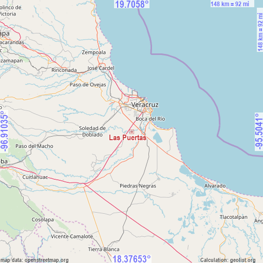
Las Puertas GPS coordinates[2]
19° 2' 33" North, 96° 12' 25.992" West
| Map corner | latitude | longitude |
|---|---|---|
| Upper-left | 19.7058°, | -96.91035° |
| Center: | 19.0425°, | -96.20722° |
| Lower-right: | 18.37653°, | -95.5041° |
| Map W x H: | 147.8×147.8 km | = 91.8×91.8mi |
| max Lat: | 32.7° ⇑64% North |
| Las Puertas: | 19.0425° |
| min Lat: | ⇓36% South 14.53588° |
| min Long | Las Puertas | max Long |
| -117.105° | -96.20722° | -86.73105° |
| W 81.4%⇐ | ⇒18.6% E |
Elevation
Elevation of Las Puertas is 25 m = 82 ft, and this is 1228.7 m = 4031 ft below average elevation for this country.
| Max E: |
3497 m = 11473 ft | 89.7% |
| Avg. | 1253.7 m = 4113 ft | |
| Las Puertas | 25 m = 82 ft | |
Min E: |
-1 m = -3 ft | 10.3% |
See also: Mexico elevation on elevation.city.
Geographical zone
Las Puertas is located in North Torrid zone (between Equator and Tropic of Cancer). Distance of this Northern Tropic circle is 488.6 km =303.6 mi to North.| Distance of | km | miles | from Las Puertas |
|---|---|---|---|
| North Pole | 7889.7 | 4902.4 | to North |
| Arctic Circle | 5283.8 | 3283.2 | to North |
| Tropic Cancer | 488.6 | 303.6 | to North |
| Equator | 2117.3 | 1315.6 | to South |


Nearby cities:
15 places around Las Puertas: (largest is in red/bold)
• Colonia Cardenista Antonio Luna
10.6 km =6.6 mi,  348°
348°
• Colonia Lázaro Cárdenas
4.5 km =2.8 mi,  74°
74°
• El Tejar
6 km =3.7 mi,  53°
53°
• Fraccionamiento Arboledas San Ramón
7.8 km =4.8 mi,  42°
42°
• Hacienda Sotavento
10.5 km =6.5 mi,  14°
14°
• Jamapa
3.6 km =2.2 mi,  268°
268°
• Juan de Alfaro
6.2 km =3.9 mi,  121°
121°
• La Gloria
9.3 km =5.8 mi,  107°
107°
• La Javilla
5.6 km =3.5 mi, 272°
• Medellín de Bravo
5.5 km =3.4 mi, 70°
• Mozambique
5.3 km =3.3 mi,  290°
290°
• Paso Colorado
7.8 km =4.8 mi, 70°
• Paso del Toro
7.6 km =4.7 mi,  96°
96°
• Rancho del Padre
4.4 km =2.7 mi, 54°
• Valle Alto
9.5 km =5.9 mi, 352°
Sources, notices
• [Note1] Compared only with cities in Mexico existing in our database
• [Src1] Map data: © OpenStreetMap contributors (CC-BY-SA)
• [Src2] Other city data from geonames.org with taken over terms of usage.
• [Src3] Geographical zone / Annual Mean Temperature by Robert A. Rohde @ Wikipedia
