Barrio la Guadalupe geodata
Barrio la Guadalupe (Oaxaca) is a populated place; located in Mexico in America/Mexico_City (GMT-6) time zone. With population of 599 people, there are 14365 cities with bigger population in this country. Compared to other cities in Mexico, 90.1% of cities are located further ↑North; 77.5% of cities are located further ←West and 51.7% of cities have lower elevation than Barrio la Guadalupe. Note1


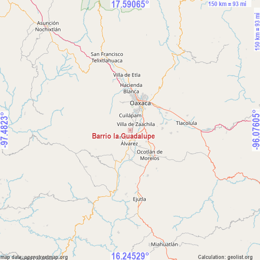
Barrio la Guadalupe GPS coordinates[2]
16° 55' 9.012" North, 96° 46' 45.012" West
| Map corner | latitude | longitude |
|---|---|---|
| Upper-left | 17.59065°, | -97.4823° |
| Center: | 16.91917°, | -96.77917° |
| Lower-right: | 16.24529°, | -96.07605° |
| Map W x H: | 149.6×149.6 km | = 93×93mi |
| max Lat: | 32.7° ⇑90.1% North |
| Barrio la Guadalupe: | 16.91917° |
| min Lat: | ⇓9.9% South 14.53588° |
| min Long | Barrio la Guada | max Long |
| -117.105° | -96.77917° | -86.73105° |
| W 77.5%⇐ | ⇒22.5% E |
Elevation
Elevation of Barrio la Guadalupe is 1513 m = 4964 ft, and this is 259.3 m = 851 ft above average elevation for this country.
| Max E: |
3497 m = 11473 ft | 48.3% |
| Barrio la Guadalupe | 1513 m 4964 ft | |
| Avg. | 1253.7 m = 4113 ft | |
Min E: |
-1 m = -3 ft | 51.7% |
See also: Mexico elevation on elevation.city.
Geographical zone
Barrio la Guadalupe is located in North Torrid zone (between Equator and Tropic of Cancer). Distance of this Northern Tropic circle is 724.7 km =450.3 mi to North.| Distance of | km | miles | from Barrio la Guadalupe |
|---|---|---|---|
| North Pole | 8125.8 | 5049.1 | to North |
| Arctic Circle | 5519.9 | 3429.9 | to North |
| Tropic Cancer | 724.7 | 450.3 | to North |
| Equator | 1881.2 | 1168.9 | to South |


Nearby cities:
15 places around Barrio la Guadalupe: (largest is in red/bold)
• Ciénega de Zimatlán
3.1 km =1.9 mi,  156°
156°
• Cuilapan de Guerrero
6.5 km =4 mi,  358°
358°
• Emiliano Zapata
6.9 km =4.3 mi,  75°
75°
• Fraccionamiento Real del Valle
1.9 km =1.2 mi,  38°
38°
• La Lobera
6.8 km =4.2 mi,  297°
297°
• Ninguno
7.9 km =4.9 mi,  88°
88°
• Reyes Mantecón
5.7 km =3.5 mi,  103°
103°
• San Lucas Tlanichico
6.6 km =4.1 mi,  332°
332°
• San Miguel Tlanichico
1.8 km =1.1 mi,  348°
348°
• San Raymundo Jalpam
6.3 km =3.9 mi,  22°
22°
• Santa Catarina Quiané
5.8 km =3.6 mi,  134°
134°
• Santa María Roaló
0.6 km =0.4 mi,  114°
114°
• Trinidad Zaachila
1.6 km =1 mi, 81°
• Villa de Zaachila
4.7 km =2.9 mi, 41°
• Zimatlán de Álvarez
5.6 km =3.5 mi,  185°
185°
Sources, notices
• [Note1] Compared only with cities in Mexico existing in our database
• [Src1] Map data: © OpenStreetMap contributors (CC-BY-SA)
• [Src2] Other city data from geonames.org with taken over terms of usage.
• [Src3] Geographical zone / Annual Mean Temperature by Robert A. Rohde @ Wikipedia
